

Quinta moves towards West Philippine Sea; LPA to enter PAR this week
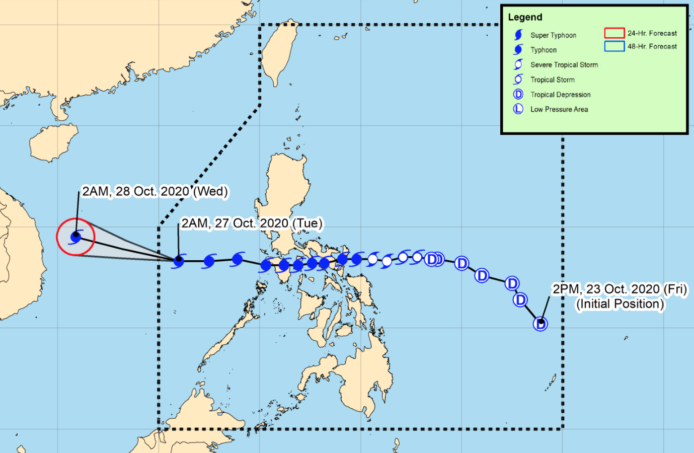
Typhoon Quinta continues to move westward over the West Philippine Sea north of Kalayaan Islands as a Low Pressure Area (LPA) is likely to enter the Philippine Area of Responsibility by Wednesday or Thursday, according to the Severe Weather Bulletin posted by PAGASA.
Tropical Cyclone Wind Signal (TCWS) No. 1 remains over Kalayaan Islands as Quinta is forecast to exit the Philippine Area of Responsibility (PAR) Tuesday morning.
The typhoon is expected to further intensify over the West Philippine Sea and reach its peak intensity within 24 hours.
Quinta will bring moderate to heavy rains over Western Visayas, Occidental Mindoro, Palawan including Calamian, Cuyo, and Kalayaan Islands, Aurora, Isabela, Cagayan and light to moderate with at times heavy rains over Zamboanga Peninsula, Bangsamoro, Northern Mindanao, Caraga, and the rest of Luzon and Visayas.
Flooding, including flash floods, and rain-induced landslides may occur during heavy or prolonged rainfall especially in areas that are highly or very highly susceptible to these hazards.
The eye of Typhoon Quinta was located based on all available data at 605 kilometers west of Calapan City, Oriental Mindoro or 305 km north northeast of Pag-asa Island, Palawan with maximum sustained winds of 140 kilometers near the center and gustiness of up to 170 kph and moving westward at 25 kph.
Strong breeze to near gale conditions will be experienced in areas under TCWS No. 1.
In other areas, strong breeze to gale conditions associated with the northeasterlies will prevail in Batanes, northern Cagayan including Babuyan Islands, Apayao, and Ilocos Norte, while occasional gusts associated with the outer circulation of Quinta will still be experienced over MIMAROPA, Western Visayas, and the western section of Luzon.
Swells of 2 to 3 meters due to Quinta can cause significant breaking waves that may bring potentially damaging surf conditions over the western coastal areas of Pangasinan, Central Luzon, Occidental Mindoro, and Palawan including Calamian Islands.
Rough to very rough seas will be experienced over the northern and western seaboards of Luzon. Sea travel is risky over these waters especially for mariners of small seacrafts.
Moderate to rough seas will be experienced over the eastern seaboards of Central Luzon, Southern Luzon, and Palawan including Cuyo Islands, the southern seaboards of Mindoro Provinces, and the western seaboards of Western Visayas.
Mariners of small seacrafts are advised to take precautionary measures when venturing out to sea. Inexperienced mariners should avoid navigating in these conditions.
As of 4 a.m., a Low Pressure Area (LPA) has been spotted outside the PAR at 1,855 kilometers east of Southern Luzon.
The LPA may enter the PAR on Wednesday or Thursday and develop into a tropical depression in the next 48 hours. -- BAP, GMA News
