

Florita accelerates slightly over Philippine Sea; Signal 1 over 3 areas
Tropical Cyclone Wind Signal (TCWS) No. 1 has been hoisted over three areas in northern Luzon as Tropical Depression Florita intensifies slightly and may become a tropical storm by Monday morning or afternoon, PAGASA said.
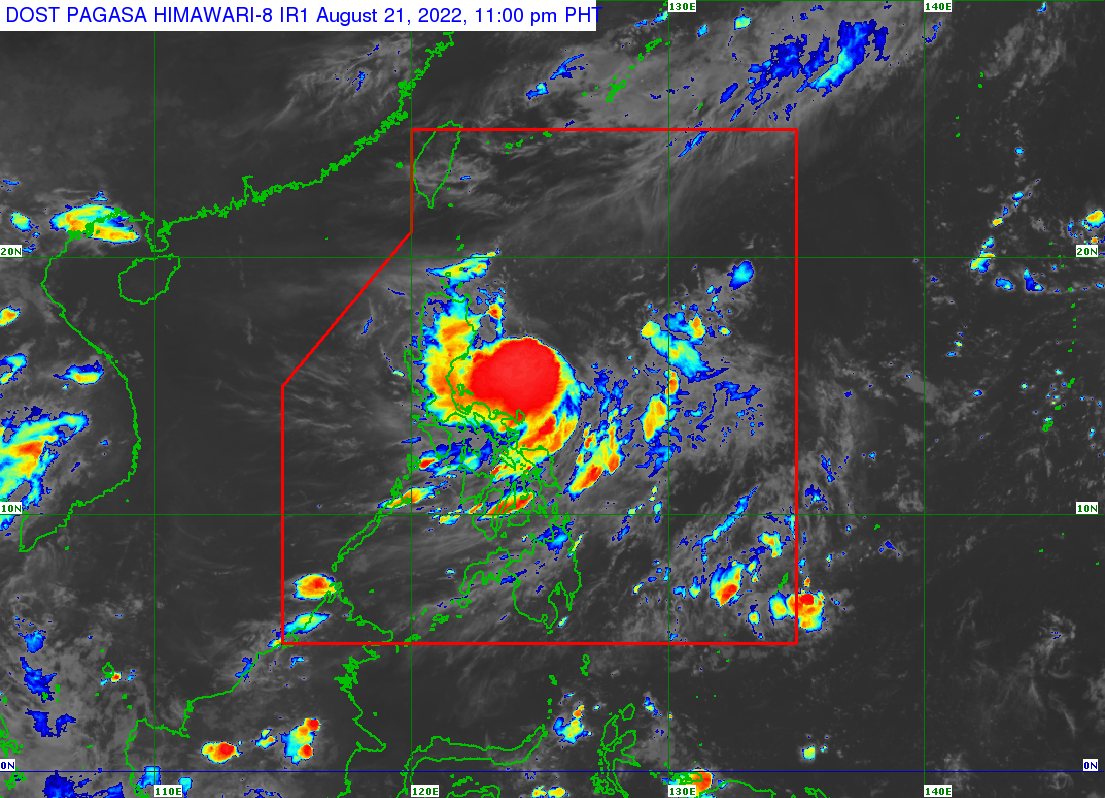
In its 11 p.m. forecast on Sunday, the state weather bureau said that Florita was 460 km east of Tuguegarao City, Cagayan and 420 km east of Casiguran, Aurora as of 10 p.m. and accelerating slightly with maximum sustained winds of 55 km/h near the center, gustiness of up to 70 km/h, and central pressure of 1000 hPa.
It is expected to continue west-southwestward or westward in the next 12 hours before turning west-northwestward or northwestward Monday afternoon or evening.
Florita may reach a peak intensity of 95 km/h on Tuesday afternoon or evening before it makes landfall on the east coast of Cagayan or in northern Isabela.
TCWS No. 1 is currently over the following areas, with strong winds prevailing or expected within the next 36 hours:
- The northern portion of Aurora (Dilasag),
- the northern and eastern portions of Isabela (Dinapigue, Palanan, Divilacan, Maconacon, San Pablo, Cabagan, Tumauini, Ilagan City, San Mariano, Benito Soliven, City of Cauayan, Naguilian, Gamu, Quirino, Delfin Albano, Santo Tomas, Santa Maria, Quezon, Mallig, Burgos, Reina Mercedes, Luna, Aurora, Roxas, Cabatuan, San Manuel),
- and the eastern portion of Cagayan (Peñablanca, Baggao, Gattaran, Lal-Lo, Gonzaga, Santa Ana, Santa Teresita, Buguey, Aparri, Camalaniugan, Alcala, Amulung, Iguig, Solana, Tuguegarao City, Enrile)
PAGASA warned that strong winds to near-gale strength will be experienced in these areas.
Over the next 24 hours, meanwhile, gusts from strong breezes to near-gale strength winds may be felt in the Bicol region, Batangas, Occidental and Oriental Mindoro, Marinduque, Romblon, Northern Samar, and Aklan due to Florita's enhancing the Southwest Monsoon or Habagat.
Light to moderate with at times heavy rains may occur in Cagayan, Isabela, Batanes, and Aurora until Monday evening.
Heavy to intense with at times torrential rains could occur over Cagayan, Isabela, Batanes, the Cordillera Administrative Region, and the Ilocos Region from Monday evening through Tuesday evening. Light to moderate with at times heavy rains will fall over the rest of Central Luzon in the same period.
Over water, meanwhile, the next 24 hours will bring moderate to rough seas (1.2 to 3.1m) over the northern and eastern seaboards of Luzon, which may be risky for small sea vessels. — BM, GMA News
