

Three areas under Signal No. 1 as Goring moves north over Philippine Sea
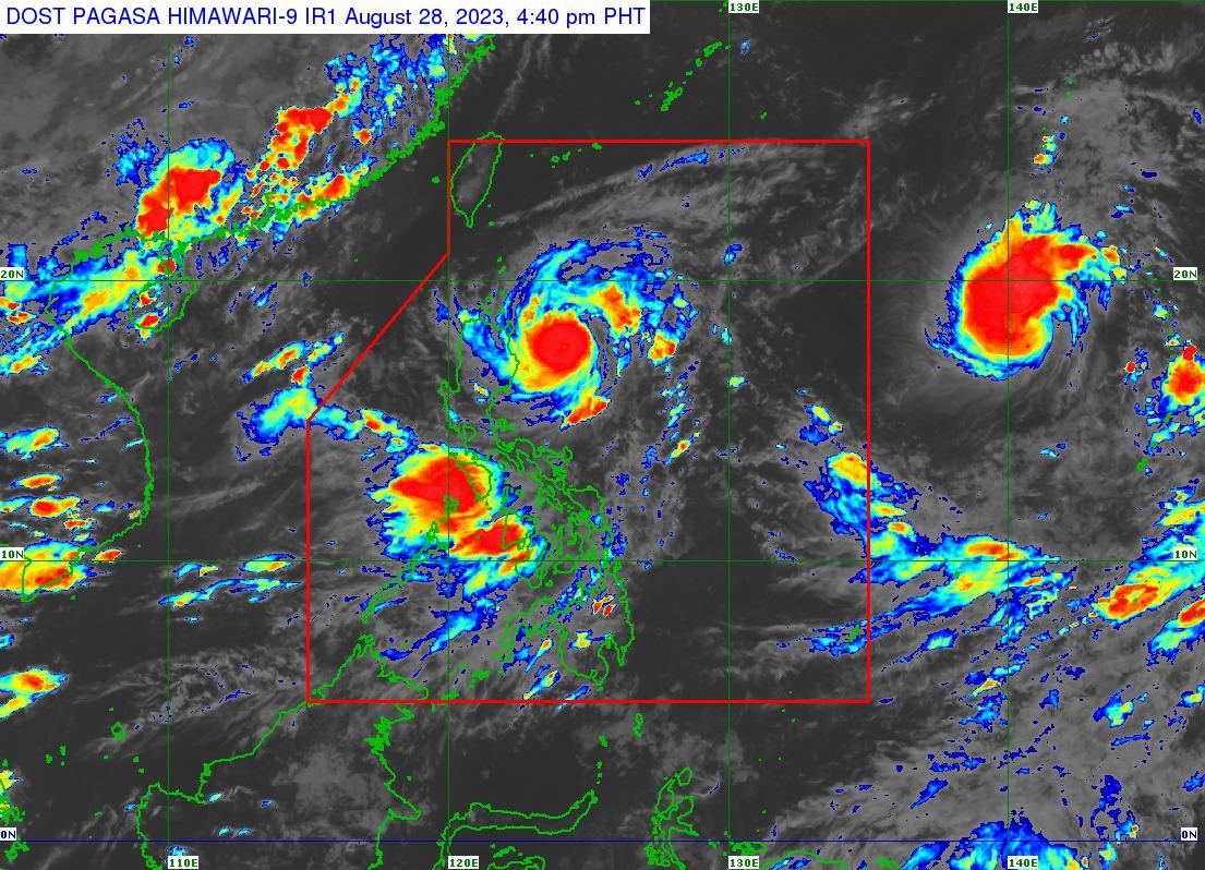
Though it has weakened since Sunday from a super typhoon, Typhoon Goring on Monday afternoon maintained its strength as it continued to move north over the Philippine Sea, PAGASA said.
As of 4 p.m., the center of Goring's eye was estimated to be 260 km east of Tuguegarao City, Cagayan, with the storm bearing maximum sustained winds of 155 km/h near the center and gustiness of up to 190 km/h as it moves northward at 15 km/h.
"Strong to typhoon-force winds extend outwards up to 280 km from the center," the state weather bureau said.
Signal No. 1 has been hoisted over the following areas:
- Batanes,
- the northern and eastern portion of mainland Cagayan (Camalaniugan, Pamplona, Gonzaga, Santa Teresita, Baggao, Buguey, Santa Ana, Claveria, Aparri, Ballesteros, Abulug, Sanchez-Mira, Santa Praxedes, Allacapan, Lal-Lo, Lasam, Peñablanca, Iguig, Amulung, Gattaran, Alcala) including Babuyan Islands, and
- the eastern portion of Isabela (Dinapigue, San Mariano, Ilagan City, Tumauini, San Pablo, Cabagan, Maconacon, Divilacan, Palanan)
Expected rainfall
Babuyan Islands and the northeastern portion of mainland Cagayan are expected to receive 50 to 100 mm from Monday to Tuesday afternoon due to Goring.
Enhanced by the typhoon, the Southwest Monsoon or Habagat meanwhile will bring occasional or monsoon rains over the western portions of central Luzon, southern Luzon, and Visayas over the next three days, PAGASA said.
Track
Goring is forecast to move north or northwest over the next 36 hours while maintaining its strength, then gradually intensify before passing close to Batanes on Wednesday afternoon, with PAGASA not ruling out the possibility of a landfall.
Goring is expected to exit the Philippine Area of Responsibility (PAR) on Thursday morning or afternoon. — BM, GMA Integrated News
