

LPA outside PAR now a tropical depression —PAGASA
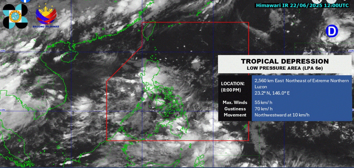
The low pressure area being monitored outside the Philippine Area of Responsibility has developed into a tropical depression, PAGASA said.
The state weather bureau said it monitored the development as of 8 p.m. Sunday, June 22, 2025.
At 2 p.m., the LPA was located 2,530 kilometers east of extreme Northern Luzon.
PAGASA said the LPA has a “high” chance of becoming a tropical depression within the next 24 hours.
For now, the Southwest Monsoon (Habagat) and the Intertropical Convergence Zone (ITCZ) are expected to affect the weather conditions in several areas across the country, according to the state weather bureau’s 4 p.m. weather forecast.
Cloudy skies with scattered rains and thunderstorms will persist over the over Davao Region and Surigao del Sur due to the ITCZ.
Metro Manila, CALABARZON, SOCCSKSARGEN, Pangasinan, Zambales, Bataan, Occidental Mindoro, and Palawan will see the same weather conditions due to the Habagat.
These moderate to at times heavy rains may cause flash floods and landslides.
The Habagat will also bring partly cloudy to cloudy skies with isolated rain showers or thunderstorms over the Bicol Region, Western Visayas, Negros Island Region, Zamboanga Peninsula, BARMM, and the rest of Central Luzon and MIMAROPA.
The same weather conditions will be observed throughout the rest of the country due to localized thunderstorms.—LDF, GMA Integrated News
