

3 LPAs monitored inside, outside PH Area of Responsibility — PAGASA
State weather bureau PAGASA is monitoring three low pressure areas (LPA) inside and outside the Philippine Area of Responsibility (PAR).
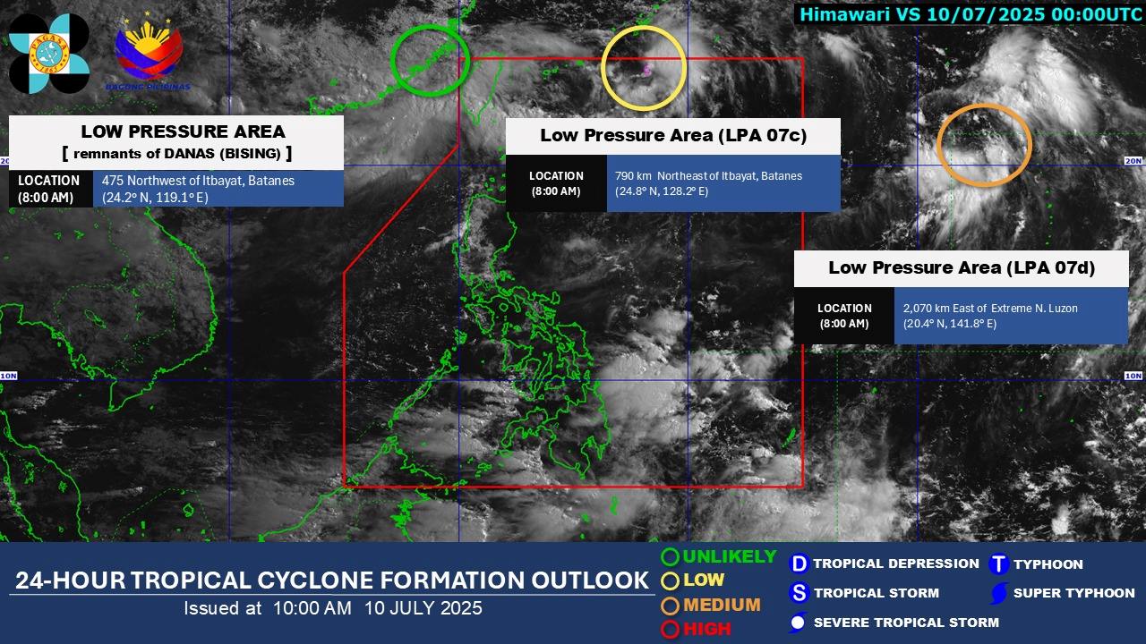
As of 8 a.m. Thursday, PAGASA said the LPA within the PAR has a low potential to develop into a tropical cyclone within the next 24 hours. It was last seen 790 kilometers northeast of Itbayat, Batanes.
Meanwhile, an LPA outside PAR has medium potential of becoming a tropical cyclone within the next 24 hours. It is a remnant of tropical cyclone Bising and was last spotted 475 northwest of Itbayat, Batanes.
Another LPA outside PAR is unlikely to become a tropical cyclone within the next 24 hours. It was last monitored 2,070 kilometers east of extreme Northern Luzon, according to PAGASA.
PAGASA earlier said the southwest monsoon or habagat would continue to bring rains over a large swath of the country.
Occasional rains may be experienced over Metro Manila, Batanes, Babuyan Islands, Zambales, Bataan, Cavite, Occidental Mindoro, and Antique while cloudy skies with scattered rains and thunderstorms may prevail over locos Region, Cordillera Administrative Region, Negros Island Region, Zamboanga Peninsula, BARMM, SOCCSKSARGEN, the rest of MIMAROPA, the rest of Western Visayas, mainland Cagayan, Tarlac, Nueva Ecija, Pampanga, Bulacan, Batangas, Rizal, and Laguna, and Davao Occidental.
The rest of the country is forecast to experience partly cloudy to cloudy skies with isolated rainshowers or thunderstorms.
PAGASA warned of floods and landslides in low-lying areas due to the rains. — VDV, GMA Integrated News
