

Tropical storm outside PAR being monitored by PAGASA
PAGASA on Saturday said it continues to monitor a tropical storm located outside the Philippine Area of Responsibility (PAR).
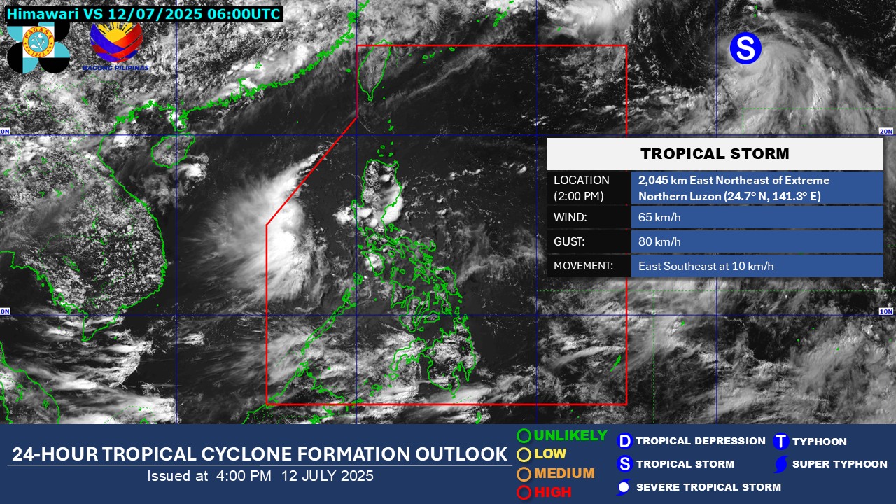
According to PAGASA, the tropical storm was last located 2,050 kilometers east northeast of Extreme Northern Luzon at 2 p.m. with maximum sustained winds of 65 kph and gustiness of up to 80 kph.
It is currently moving east-southeastward at 10 kph as of 3 p.m.
Meanwhile, PAGASA said that the Southwest Monsoon, or habagat, will bring rains in parts of the country.
Occasional rains may be expected in Occidental Mindoro and Palawan.
Cloudy skies with scattered rains and thunderstorms may be expected over Visayas, Zamboanga Peninsula, BARMM, Northern Mindanao, Caraga, Zambales, Bataan, Cavite, Batangas, Sorsogon, Masbate, and the rest of MIMAROPA.
Metro Manila and the rest of the country will be having partly cloudy to cloudy skies with isolated rain showers or thunderstorms.
Possible flash floods or landslides may occur in some areas as a result of said weather conditions.
Meanwhile, moderate winds with moderate waters may be felt over the northern and western sections of Luzon.
The rest of the country will be having light to moderate winds with slight to moderate coastal waters.
Sunrise in Metro Manila will be at 5:34 a.m. on Sunday. —Jiselle Anne Casucian/ VAL, GMA Integrated News
