

Huaning exits PAR, heads for Japan's Ryukyu Islands
Tropical Depression Huaning has exited the Philippine Area of Responsibility (PAR) as of 5 a.m. Tuesday, PAGASA reported.
According to the state weather bureau’s 11 a.m. bulletin, Huaning is now at 880 kilometers northeast of Extreme Northern Luzon outside the PAR.
It had maximum sustained winds of 55 kph, gustiness of up to 70kph, and continues to accelerate.
No wind signals were hoisted over any parts of the country, and Huaning is unlikely to affect the country or its sea conditions.
Huaning is predicted to possibly make landfall over the Ryuku Islands in Japan within the day.
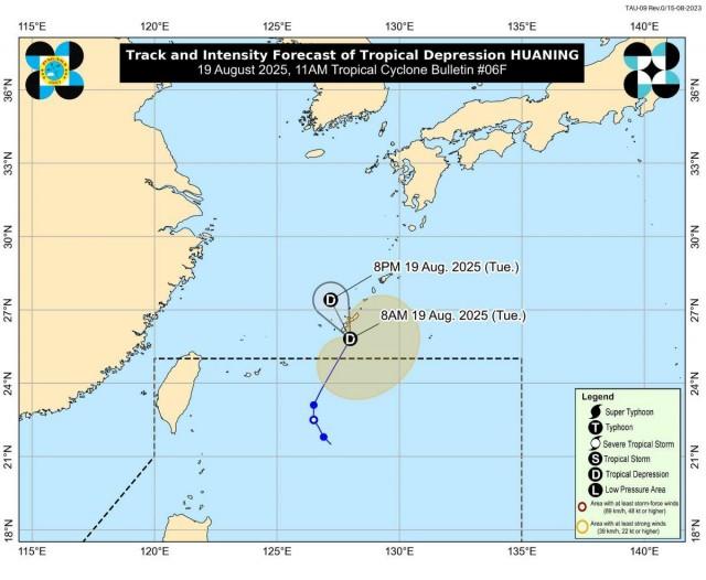
It is also likely to remain as a tropical depression throughout the forecast period, as intensification was deemed “not the most likely scenario.”
Meanwhile, in a 10 a.m. advisory, PAGASA noted that a low pressure area (LPA), with a medium chance of becoming a tropical storm within the next 24 hours, is being monitored outside the PAR.
If it enters PAR, the LPA could approach Northern Luzon and bring rains to the eastern section of the region, although forecasters noted there is still high uncertainty in its track and development. —Sherylin Untalan and Jiselle Anne C. Casucian/KG, GMA Integrated News
