

Habagat slightly enhanced by Isang to bring strong to gale-force gusts over Luzon
The Southwest Monsoon (Habagat) slightly enhanced by Tropical Storm Isang, which is now outside the Philippine Area of Responsibility (PAR), is expected to bring strong to gale-force gusts over some areas in Luzon, PAGASA said Saturday.
In its 11 a.m. bulletin, PAGASA said strong to gale-force gusts will prevail over:
- Batanes;
- Babuyan Islands;
- Ilocos Region
- Cordillera Administrative Region;
- Zambales;
- Bataan;
- Lubang Island;
- Romblon; and
- Kalayaan Islands.
No Tropical Cyclone Wind Signal was issued.
Meanwhile in its separate weather advisory for the Southwest Monsoon, PAGASA said rains of 50-100 millimeters may be expected in Zambales, Bataan, and Occidental Mindoro.
"Localized flooding is possible mainly in areas that are urbanized, low lying, or near rivers," the state bureau warned, adding that "[Landslides are] possible in highly susceptible areas."
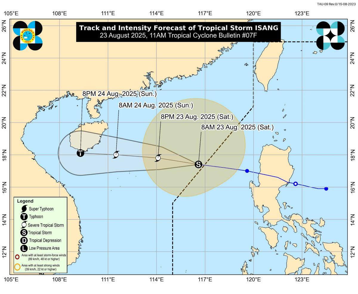
Based on its track and intensity outlook, Tropical Storm Isang will continue moving westward and is forecast to make landfall or pass close to Hainan, China on Sunday afternoon or evening.
Further, the tropical cyclone will continue to intensify throughout the forecast period and reach severe tropical storm category on Saturday afternoon or evening. Furthermore, it may reach typhoon category on Sunday evening.
The center of the eye of Isang was estimated based on all available data at 440 km west of Bacnotan, La Union, outside PAR.
Moving westward at 30 km/h, it has maximum sustained winds of 85 km/h near the center and gustiness of up to 105 km/h. —KG, GMA Integrated News
