

LPA with high chance of becoming cyclone spotted off Mindanao
Weather bureau PAGASA said on Saturday afternoon that there is now a high probability that the low pressure area off the coast of Mindanao will develop into a tropical cyclone.
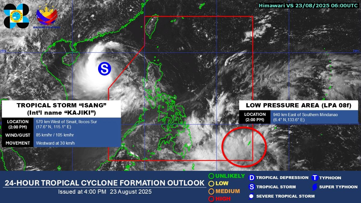
At 2 p.m., the LPA was located 940 km east of southern Mindanao.
"The low pressure area (LPA 08F) located inside the PAR [Philippine Area of Responsibility] is also being monitored and has now a 'high' potential of developing into a tropical depression within the next 24 hours," PAGASA said in its 4 p.m. advisory.
In the next 24 hours, PAGASA said the trough of the LPA may cause cloudy skies with scattered rains and thunderstorms over Caraga, the Davao Region, Northern Mindanao, Sarangani, Eastern Samar, Leyte, Southern Leyte, and Bohol.
If this weather disturbance turns into a tropical depression, it will be the 10th cyclone to enter the PAR this year and the fifth for August alone. PAGASA has prepared the name Jacinto for the 10th tropical cyclone in 2025.
On Saturday morning, Tropical Storm Isang exited the PAR a day after crossing several provinces in Northern Luzon and enhancing the Southwest Monsoon (Habagat) that brought heavy rains.
The trough of Isang will bring cloudy skies with scattered rains and thunderstorms over the Ilocos Region, Abra, and Benguet, while the Southwest Monsoon will affect Metro Manila, Central Luzon, CALABARZON, MIMAROPA, the Negros Island Region, and Western Visayas.
The rest of Luzon will experience localized thunderstorms.
Winds and seas will be moderate in the northern and western sections of Northern Luzon. The rest of the country will have light to moderate winds and slight to moderate coastal waters.
Sunrise in Metro Manila will be at 5:43 a.m. on Sunday. –VBL, GMA Integrated News
