

Tropical Depression Kiko to exit PAR by Wednesday afternoon
Tropical Depression Kiko is expected to accelerate and exit the Philippine area of responsibility Wednesday afternoon, state weather bureau PAGASA said.
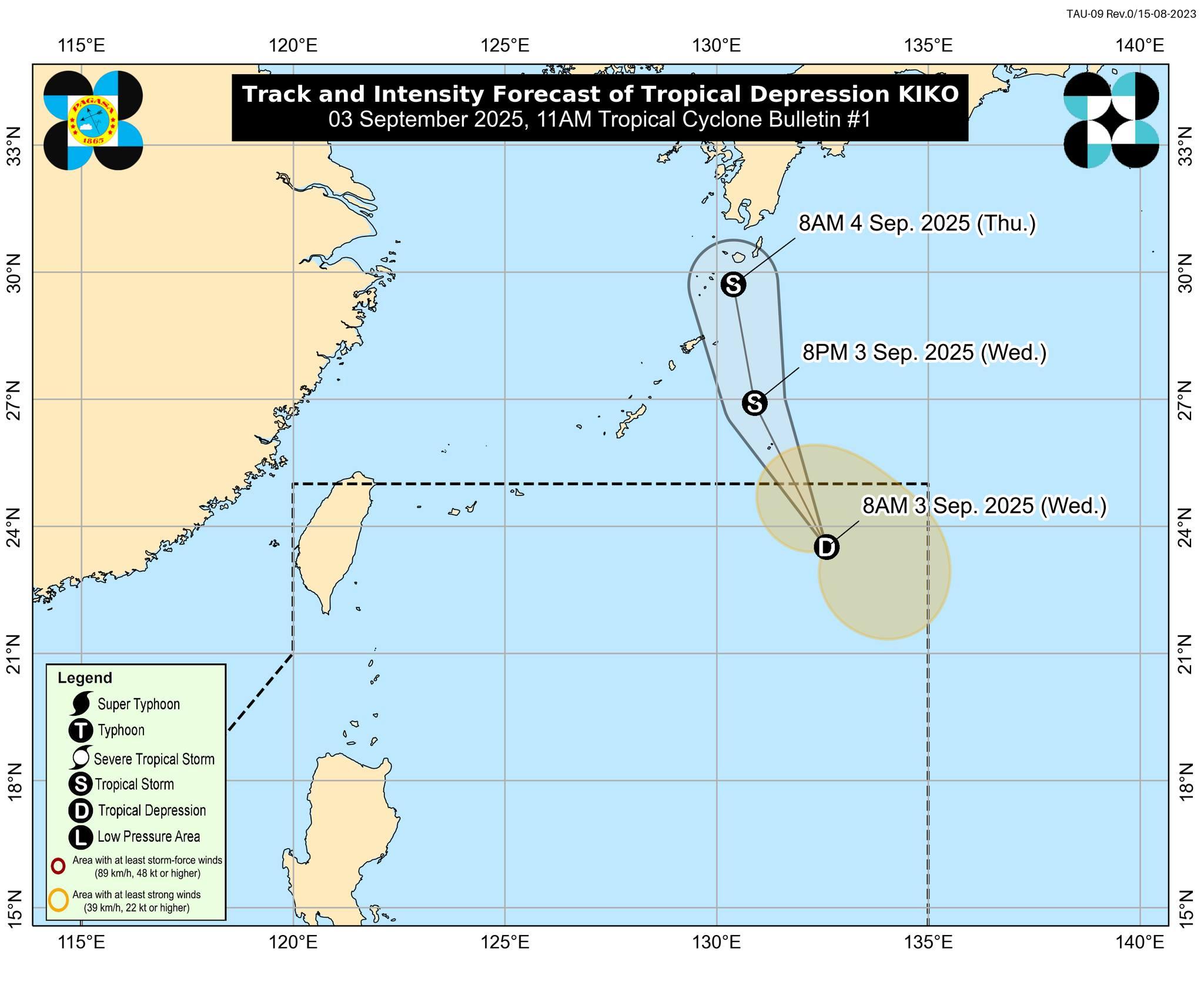
In its 11 a.m. tropical cyclone bulletin, PAGASA said Kiko will move generally northward or north northwestward in the next 24 hours towards southern Japan.
It is also forecast to intensify into tropical storm Wednesday or early Thursday morning.
Kiko developed into a tropical depression near the east northeast of Extreme Northern Luzon.
As of 10 a.m., the center of Kiko was located 1,170 km east northeast of Extreme Northern Luzon and moving northward at 15 km/h.
It is packing maximum sustained winds of 55 km/h near the center, gustiness of up to 70 km/h, and central pressure of 1004 hPa.
Currently, no tropical cyclone wind signals or coastal hazards are raised over the country.
PAGASA said Kiko is unlikely to directly affect the country and sea condition in the coastal waters throughout the forecast period.
Despite this, the weather bureau advised the public and disaster risk reduction and management offices concerned to take all necessary measures to protect life and property.
"Persons living in areas identified to be highly or very highly susceptible to hazards are advised to follow evacuation and other instructions from local officials," it said.—Jiselle Anne Casucian/AOL, GMA Integrated News
