

Tropical Depression Kiko leaves PAR
Tropical Depression Kiko has exited the Philippine Area of Responsibility (PAR), the state weather bureau PAGASA said Wednesday afternoon.
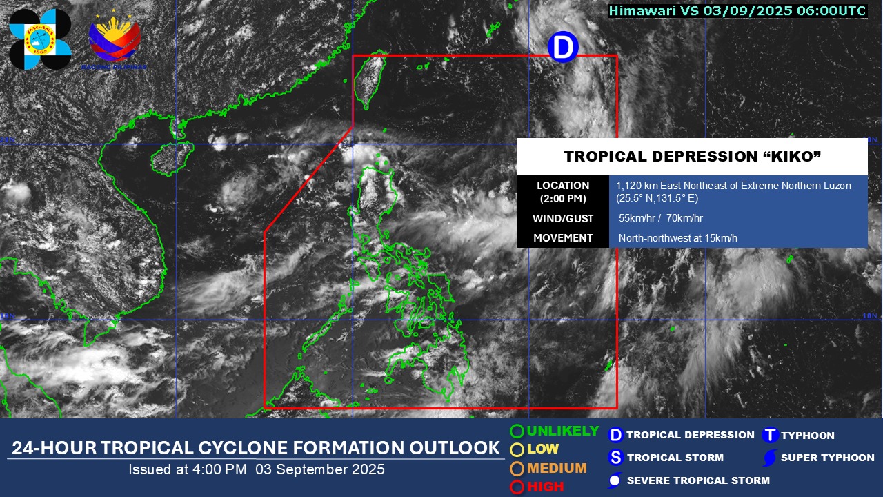
PAGASA said Kiko, which became a tropical depression earlier in the day, left PAR at 2 p.m. It was located 1,120 km east northeast of Extreme Northern Luzon, with maximum sustained winds of 55 km/h near the center and gustiness of up to 70 km/h.
Kiko is expected to head for southern Japan, moving north northwest at 15 km/h.
"Due to favorable environmental conditions, Kiko is forecast to intensify into tropical storm tonight or tomorrow (September 4) early morning," the weather bureau said.
PAGASA said Kiko had no direct impact on the weather in the Philippines.
Based on PAGASA’s 4 p.m. weather forecast, the Southwest Monsoon (Habagat) will bring cloudy skies and rain over the Ilocos Region, Cordillera Administrative Region, Batanes, Babuyan Islands, Cagayan, Isabela, Zambales, Bataan, Metro Manila, the rest of Luzon, and Western Visayas.
Meanwhile, the rest of the country will experience partly cloudy to cloudy skies with isolated rain showers or thunderstorms due to localized thunderstorms.
The state weather bureau warned the public that these weather conditions may cause flash floods or landslides.
Winds will be light to moderate while coastal waters will be slight to moderate throughout the country.
Sunrise in Metro Manila will be at 5:44 a.m. on Thursday. — with Mariel Celine Serquiña/VBL, GMA Integrated News
