

LPA inside PAR has 'medium' chance of becoming TD
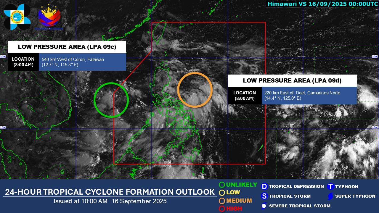
One of two Low Pressure Areas (LPA) inside the Philippine Area of Responsibility being monitored by PAGASA has a "medium chance" of becoming a tropical depression within the next 24 hours.
PAGASA said the LPA was last spotted within the Philippine Area of Responsibility (PAR) at 540 kilometers west of Coron, Palawan as of 8 a.m.
Meanwhile, the other LPA at 220 kilometers east of Daet, Camarines Norte has an "unlikely" chance of turning into a tropical depression within the next 24 hours.
In an earlier weather forecast, PAGASA said that some areas of the country will experience rainfall due to the effects of the LPA, Easterlies, the Southwest Monsoon, and localized thunderstorms.
Bicol Region, Central Visayas, Eastern Visayas, Aurora, Quezon, Rizal, Bulacan, Nueva Ecija, Quirino, and Nueva Vizcaya will have cloudy skies with scattered rains and thunderstorms due to the LPA.
As a result of the trough of LPA, Metro Manila, MIMAROPA, the rest of Central Luzon, rest of CALABARZON, and the rest of Visayas will experience cloudy skies with scattered rains and thunderstorms.
The rest of Cagayan Valley will see cloudy skies with scattered rains and thunderstorms brought by the easterlies.
The same weather system, the easterlies, will bring partly cloudy to cloudy skies with isolated rainshowers or thunderstorms to the Ilocos Region and the Cordillera Administrative Region.
Meanwhile, Zamboanga Peninsula, Northern Mindanao, BARMM, and SOCCSKSARGEN will have cloudy skies with scattered rains and thunderstorms as a result of the Southwest Monsoon.
The rest of Mindanao will have partly cloudy to cloudy skies with isolated rainshowers or thunderstorms due to localized thunderstorms. —VAL, GMA Integrated News
