

Mirasol reaches Apayao, 14 areas under Signal No. 1
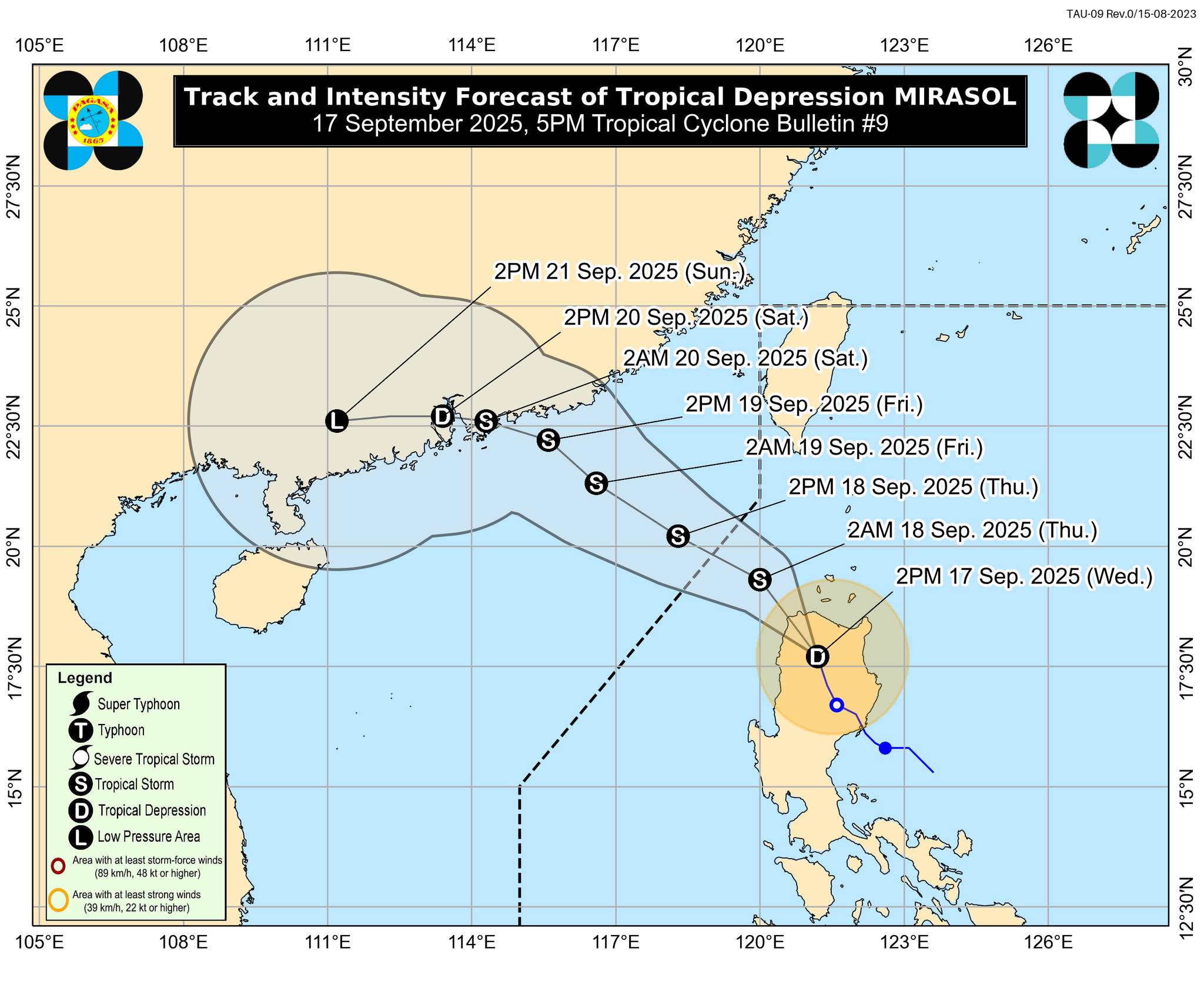
Tropical Depression Mirasol has reached Apayao with 14 Luzon areas under Signal No. 1, according to PAGASA's 5 p.m. Thursday bulletin.
- Batanes
- Cagayan including Babuyan Islands
- the western and northern portions of Isabela (Santo Tomas, Alicia, San Mateo, Aurora, Santa Maria, Quezon, Ramon, Naguilian, Roxas, Luna, Delfin Albano, City of Cauayan, San Pablo, Ilagan City, City of Santiago, Tumauini, Cabagan, Reina Mercedes, San Manuel, Cabatuan, Quirino, Gamu, San Isidro, Mallig, Cordon, Maconacon, Burgos, Divilacan)
- the northwestern portion of Quirino (Diffun, Saguday)
- the northern portion of Nueva Vizcaya (Kayapa, Ambaguio, Bayombong, Villaverde, Solano, Quezon, Bagabag, Diadi)
- Apayao
- Abra
- Kalinga
- Mountain Province
- Ifugao
- the northern portion of Benguet (Bakun, Mankayan, Buguias, Kabayan, Atok, Kibungan, Kapangan, Bokod)
- Ilocos Norte
- Ilocos Sur
- the northern portion of La Union (Luna, Bangar, Sudipen, Santol, San Gabriel, Balaoan, Bacnotan, San Juan, City of San Fernando, Bagulin)
At 4 p.m., Mirasol was monitored in the vicinity of Kabugao, Apayao, carrying maximum sustained winds of 55 km/h near the center and gustiness of up to 90 km/h. It was traveling northwestward at 20 km/h.
“This tropical depression will re-emerge over the coastal waters of Ilocos Norte tonight,” PAGASA said.
The state weather bureau said Mirasol is expected to continue traversing Northern Luzon and move northwestward within the next 12 hours, until it exits the Philippine Area of Responsibility (PAR) Thursday morning.
It will maintain its strength as it crosses the Northern Luzon landmass.
“Once it is over the waters west of Ilocos Norte, it is forecast to intensify and may reach tropical storm category tonight or tomorrow early morning,” PAGASA said.
Mirasol will remain a tropical storm category throughout the forecast period, but further intensification to a severe tropical storm is not ruled out, it added.
State meteorologists also said hoisting of Wind Signal No. 2 is possible over some portions of Northern Luzon.
Meanwhile, the Southwest Monsoon will bring strong to gale-force gusts in Metro Manila, Isabela, Cagayan, including Babuyan Islands, Batanes, Ilocos Region, Zambales, Bataan, Cavite, Quezon, Bicol Region, MIMAROPA, and Western Visayas on Thursday.
At 2 p.m., PAGASA located a tropical depression 1,255 kilometers east of southeastern Luzon, moving west northwestward at 25 km/h.
It has maximum sustained winds of 45 km/h near the center and gustiness of up to 55 km/h.
This tropical depression will be called Nando once it enters PAR. —Mariel Celine Serquiña/VBL, GMA Integrated News
