

Nando picks up strength, moves northwestward
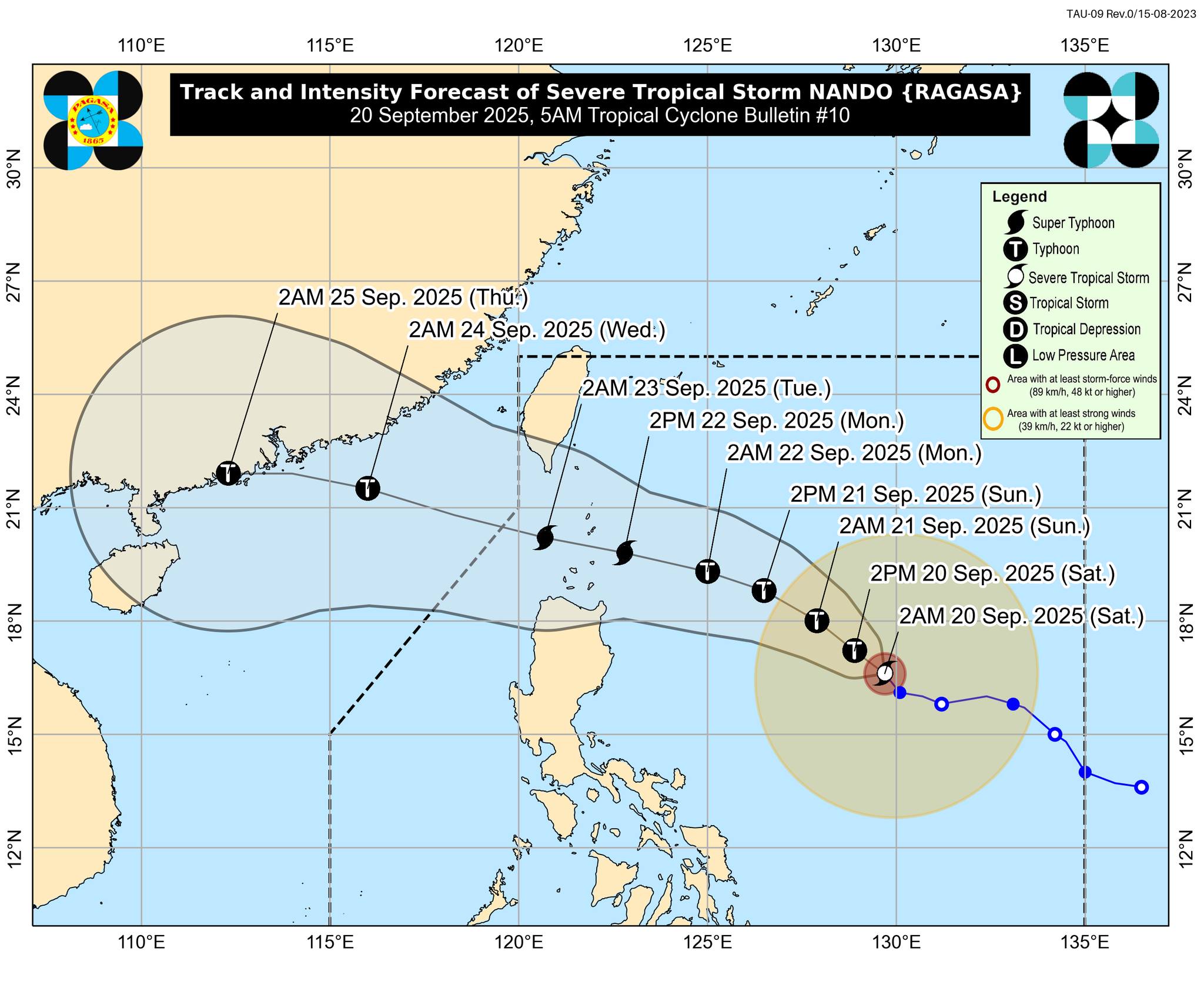
Severe Tropical Storm Nando has further intensified while moving across the Philippine Sea, according to PAGASA's bulletin released at 5 a.m. on Saturday.
At 4 a.m., Nando was spotted 780 km east of Casiguran, Aurora, packing maximum sustained winds of 100 km/h near the center and gustiness of up to 125 km/h.
Moving northwestward at 10 km/h, Nando will enhance the Southwest Monsoon (Habagat) as it approaches the landmass, PAGASA said.
"Wind Signal No. 1 will be hoisted over Northern Luzon within the day, and the highest wind signal that may be hoisted throughout its passage is Wind Signal No. 5," it said.
Nando is expected to develop into a typhoon within the next 12 hours and a super typhoon by Monday before its close approach to the Batanes-Babuyan Islands.
The center of Nando may approach or land over Batanes or the Babuyan Islands on Monday afternoon or evening, according to the forecast track.
It may exit the Philippine Area of Responsibility by Tuesday morning or noon. —VBL, GMA Integrated News
