

Paolo maintains strength as it moves closer to Luzon
Severe Tropical Storm Paolo maintained its strength as it continued to move westward closer to Northeastern Luzon, according to PAGASA.
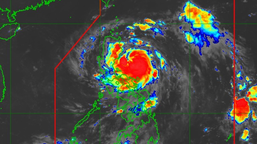
In its 2 a.m. Tropical Cyclone Bulletin on Friday, the state weather bureau said the center of Paolo was estimated “based on all available data including those from Baler and Daet Doppler Weather Radar at 255 km East of Baler, Aurora (15.8°N, 124.0°E)” as of 1 a.m.
The storm packed maximum sustained winds of 95 km/h near the center, gustiness of up to 115 km/h, and central pressure of 994 hPa.
PAGASA said Paolo has “strong to storm-force winds extend outwards up to 350 km from the center”.
Signal No. 3 is in effect over the following areas:
LUZON:
- The extreme northern portion of Aurora (Dilasag, Casiguran),
- The central and southern portions of Isabela (Dinapigue, San Mariano, San Guillermo, Echague, Jones, San Agustin, Cordon, City of Santiago, Ramon, San Isidro, Alicia, Angadanan, City of Cauayan, Benito Soliven, Naguilian, Luna, Reina Mercedes, Cabatuan, San Mateo, Aurora, San Manuel, Burgos, Gamu, Roxas, Palanan),
- The northern portion of Quirino (Maddela, Cabarroguis, Aglipay, Saguday, Diffun),
- The northern portion of Nueva Vizcaya (Diadi, Bagabag, Villaverde, Ambaguio, Quezon, Solano, Bayombong)
- Mountain Province,
- Ifugao,
- The southeastern portion of Abra (Tubo),
- The northern portion of Benguet (Mankayan, Buguias, Kabayan, Bakun, Kibungan, Atok),
- The central and southern portions of Ilocos Sur (Sugpon, Alilem, Cervantes, Suyo, Tagudin, Santa Cruz, Sigay, Quirino, Gregorio del Pilar, Salcedo, Santa Lucia, City of Candon, San Emilio, Galimuyod, Lidlidda, Banayoyo, Santiago),
- The northern portion of La Union (Sudipen, Santol, Balaoan, Luna, Bangar)
Signal No.2 has been hoisted over these locations:
LUZON:
- The southern portion of mainland Cagayan (Peñablanca, Tuguegarao City, Enrile, Solana, Iguig, Tuao, Piat, Rizal),
- The rest of Isabela,
- The rest of Quirino, The rest of Nueva Vizcaya,
- The northern and central portions of Aurora (Dinalungan, Dipaculao, Baler, Maria Aurora),
- The northeastern portion of Nueva Ecija (Carranglan, Pantabangan),
- The southern portion of Apayao (Conner),
- Kalinga,
- The rest of Abra,
- The rest of Benguet, The southern portion of Ilocos Norte (Nueva Era, Badoc, Pinili, City of Batac, Paoay, Currimao, Banna),
- The rest of Ilocos Sur,
- The rest of La Union
Signal No.1 is in effect in these areas:
LUZON:
- The rest of mainland Cagayan including Babuyan Islands,
- The rest of Aurora, the northern portion of Quezon (General Nakar, Infanta) including Polillo Islands,
- Camarines Norte,
- The northern portion of Camarines Sur (Siruma, Tinambac, Lagonoy, Garchitorena, Caramoan, Goa, San Jose, Presentacion),
- Catanduanes,
- The rest of Apayao,
- The rest of Ilocos Norte,
- Pangasinan,
- The rest of Nueva Ecija,
- The northern portion of Bulacan (Doña Remedios Trinidad, San Miguel, San Ildefonso, Norzagaray, San Rafael),
- Tarlac,
- The northeastern portion of Pampanga (Magalang, Arayat, Candaba, Mabalacat City),
- The northern portion of Zambales (Palauig, Masinloc, Candelaria, Santa Cruz)
“On the forecast track, PAOLO may make landfall over Isabela or northern Aurora this morning or noon. Further southward shift of track is possible depending on the strength of the high pressure area located north of PAOLO. After crossing the landmass of Northern Luzon, it will emerge over the West Philippine Sea by the afternoon and will continue moving west northwestward until it exits the Philippine Area of Responsibility by tomorrow (04 October) morning,” state meteorologists said.
PAGASA added that “since the possibility of reaching typhoon category before landfall is not ruled out, the worst-case scenario is Wind Signal No. 4.”
The agency said there is “a moderate to high risk of life-threatening storm surge with peak heights reaching 1.0 to 3.0 m within 24 hours over the low-lying or exposed coastal localities of Ilocos Norte, Ilocos Sur, La Union, Pangasinan, Zambales, Cagayan, Isabela, Aurora, and Quezon.”
Paolo, according to PAGASA, will continue to intensify while over the Philippine Sea.
“Further intensification into a typhoon prior to landfall is not ruled out. However, based on the intensity forecast, intensification into typhoon is highly likely once PAOLO emerges over the West Philippine Sea.”
The next tropical cyclone bulletin will be issued at 5:00 AM today. —RF, GMA Integrated News
