

Ramil maintains strength; 14 areas under Signal No. 2
A total of 14 areas are now under Signal No. 2 as Tropical Storm Ramil continues to move over mainland Bicol late Saturday evening.
According to PAGASA’s 11 p.m. bulletin, the following areas are under Tropical Cyclone Wind Signal No. 2:
- The southeastern portion of Isabela (Dinapigue)
- The southeastern portion of Quirino (Nagtipunan, Maddela, Aglipay)
- The central and southern portions of Nueva Vizcaya (Alfonso Castañeda, Dupax del Sur, Dupax del Norte, Bambang, Aritao, Kayapa, Santa Fe, Kasibu)
- The central and southern portions of Benguet (Itogon, Bokod, Atok, Kapangan, Tublay, La Trinidad, Baguio City, Tuba, Sablan)
- The central and southern portions of La Union (Rosario, Pugo, Tubao, Santo Tomas, Agoo, Aringay, Caba, Naguilian, Burgos, Bagulin, Bauang, City of San Fernando, San Juan, San Gabriel, Bacnotan, Santol, Balaoan, Luna)
- The eastern portion of Pangasinan (San Nicolas, Natividad, San Quintin, Umingan, Balungao, Santa Maria, Tayug, San Manuel, Asingan, Sison, Pozorrubio, Binalonan, San Fabian, San Jacinto, Laoac, Manaoag, City of Urdaneta, Rosales, Villasis)
- Aurora
- The eastern portion of Nueva Ecija (Talavera, Rizal, Laur, Llanera, Pantabangan, Science City of Muñoz, Palayan City, Gabaldon, General Mamerto Natividad, Carranglan, General Tinio, San Jose City, Lupao, Bongabon, Talugtug)
- The northern portion of Quezon (General Nakar), including the Polillo Islands
- Camarines Norte
- Catanduanes
- The northern and eastern portions of Camarines Sur (Tinambac, Siruma, Goa, San Jose, Lagonoy, Garchitorena, Caramoan, Presentacion, Sagñay, Tigaon)
- The eastern portion of Albay (Rapu-Rapu, Bacacay, City of Tabaco, Malilipot, Santo Domingo, Manito, Tiwi, Malinao)
- The northeastern portion of Sorsogon (Prieto Diaz, City of Sorsogon)
Under Signal No. 1 are the following areas:
- Cagayan, including the Babuyan Islands
- The rest of Isabela
- The rest of Quirino
- The rest of Nueva Vizcaya
- Apayao
- Abra
- Kalinga
- Mountain Province
- Ifugao
- The rest of Benguet
- Ilocos Norte
- Ilocos Sur
- The rest of La Union
- The rest of Pangasinan
- The rest of Nueva Ecija
- The eastern portion of Bulacan (Doña Remedios Trinidad, Norzagaray, San Miguel, San Ildefonso, San Rafael, Angat)
- The eastern portion of Tarlac (Camiling, San Clemente, Santa Ignacia, Paniqui, Moncada, San Manuel, Anao, Ramos, Pura, Victoria, City of Tarlac, La Paz, Concepcion, Gerona)
- The eastern portion of Pampanga (Magalang, Arayat, Candaba)
- The northern and eastern portions of Quezon (Tagkawayan, Perez, Alabat, Quezon, Atimonan, Padre Burgos, Unisan, Gumaca, Plaridel, Agdangan, Pagbilao, Mauban, Calauag, Guinayangan, Lopez, Pitogo, Macalelon, General Luna, Catanauan, San Narciso, Buenavista, San Francisco, San Andres, Mulanay, General Nakar, Infanta, Real, Sampaloc)
- The eastern portion of Rizal (Rodriguez, Tanay, Baras, City of Antipolo)
- The northeastern portion of Laguna (Santa Maria, Siniloan, Famy, Pangil, Pakil, Mabitac, Paete, Kalayaan, Lumban)
- The rest of Camarines Sur
- The rest of Albay
- The rest of Sorsogon
- Burias Island
- Ticao Island
- Northern Samar
- The northern portion of Eastern Samar (Jipapad, San Policarpo, Oras, Arteche, Maslog)
- The northern portion of Samar (Matuguinao, Calbayog City, Gandara, Santa Margarita, Pagsanghan, Tagapul-An, Almagro, Santo Niño, San Jose de Buan)
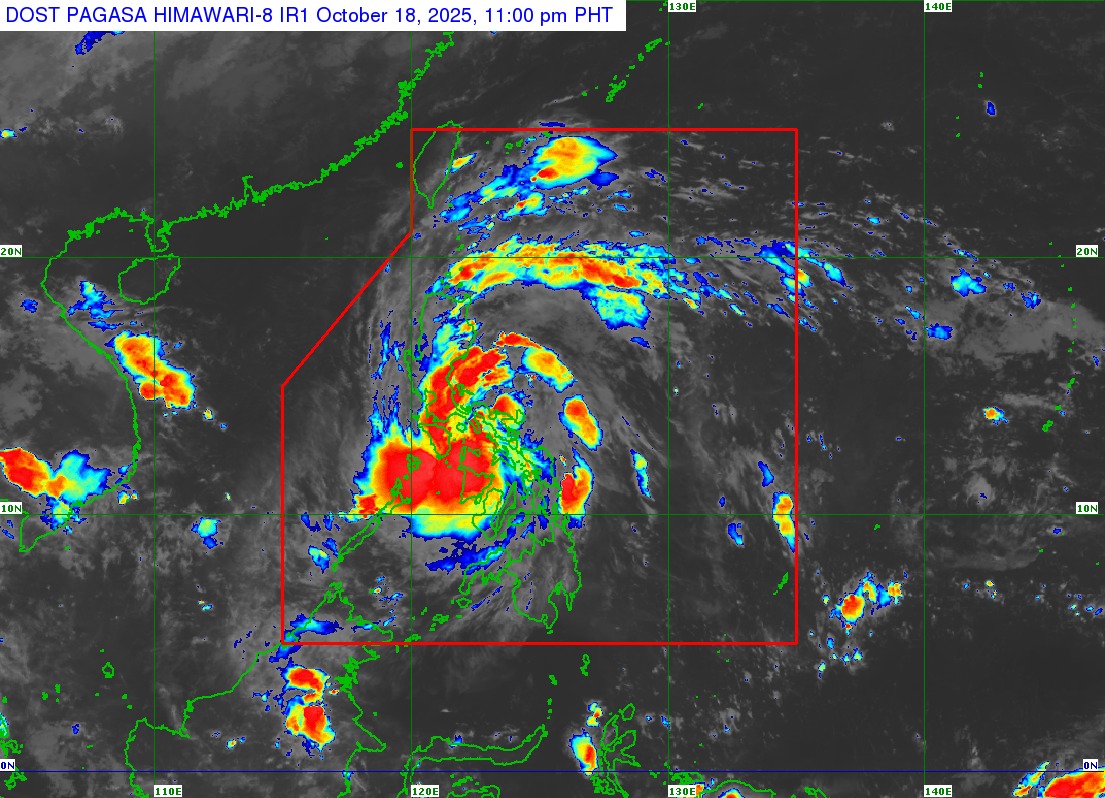
Ramil was in the Calabanga, Camarines Sur, area at 10 p.m., with maximum sustained winds of 65 km/h and gustiness of up to 110 km/h, which had not changed from three hours earlier.
It was traveling northwestward at 25 km/h.
It is expected to continue moving over Bicol and waters over Polillo Islands before making a final landfall over the vicinity of Aurora, northern Quezon, or southern Isabela by Sunday morning or afternoon.
While slight intensification may be possible before landfall, Ramil is expected to maintain strength or slightly weaken throughout the forecast period.
It may intensify into a severe tropical storm once it exits the Philippine Area of Responsibility.
Meanwhile, areas not under wind signals may still feel strong to gale-force gusts due to the combined effects of Ramil and the easterlies.
PAGASA also warned of minimal to moderate risk of storm surge with peak heights of 1.0 to 2.0 m within 36 hours over Isabela, Ilocos Norte, Ilocos Sur, La Union, Pangasinan, Zambales, Aurora, Quezon, Marinduque, Camarines Norte, Camarines Sur, Catanduanes, Albay, and Masbate.
A gale warning was also placed over the eastern seaboard of Southern Luzon, posing a risk for mariners and sea vessels of all types and tonnage. —Jiselle Anne Casucian/VBL, GMA Integrated News
