

LPA outside PAR now has 'high' chance of becoming tropical depression
The low pressure area (LPA) outside of the Philippine area of responsibility (PAR) now has a “high potential” of becoming a tropical depression within the next 24 hours, the state weather bureau said early Tuesday.
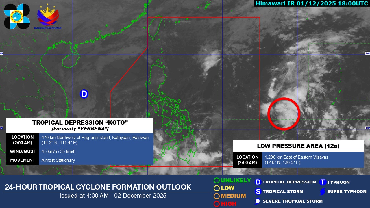
In its 4 a.m. update, PAGASA said the LPA was estimated to be 1,290 km east of Eastern Visayas as of 2 a.m. Tuesday. It may enter the PAR by Wednesday as a tropical depression.
It will be called Wilma once it develops into a tropical depression.
In its previous update on Monday night, the state weather bureau said the LPA then had a “medium” chance of becoming a tropical depression.
In its Tropical Cyclone Threat Potential Advisory, the state weather bureau said there is a “low to moderate likelihood” of tropical cyclone development in the first week of December.
Once the LPA has developed into a tropical depression, it is seen to cross the CARAGA, Visayas, and Southern Luzon.
In the second week of December, it is expected to move towards the Mindoro and Palawan area before exiting the PAR.
Meanwhile, Tropical Storm Koto (formerly Verbena) was spotted 470 km northwest of Pag-asa Island in Kalayaan, Palawan outside the PAR. It is almost stationary and is packing winds of 45 km/h and gustiness of 55 km/h. — JMA, GMA Integrated News
