

PAGASA: Ada maintains move eastward; LPA outside PAR being monitored
Tropical Depression Ada continues to move eastward while over the Philippine Sea, according to the latest Tropical Cyclone Bulletin posted by PAGASA.
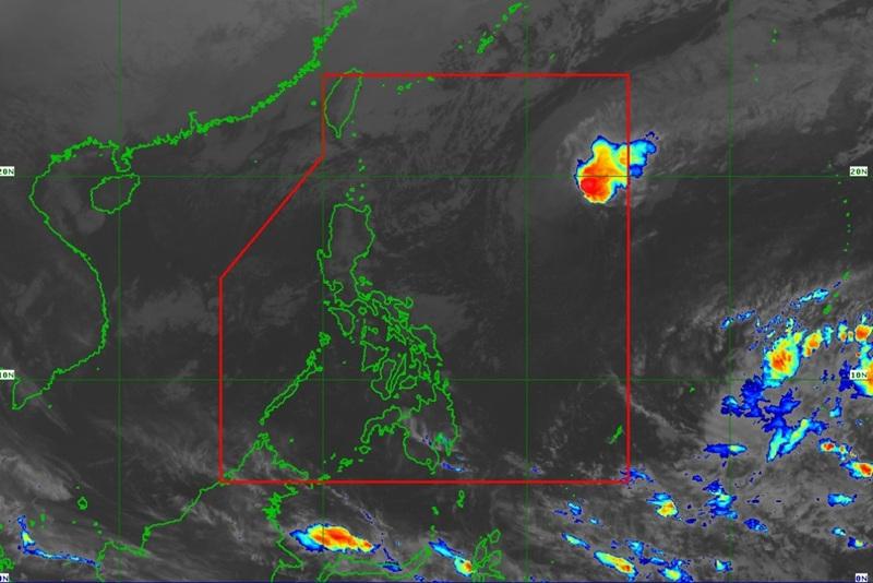
The center of Tropical Depression ADA was estimated at 1,120 kilometers East of Northern Luzon with maximum sustained winds of 55 kilometers per hour near the center, gustiness of up to 70 km/h and moving Eastward at the speed of 30 km/h.
The state weather bureau also reported that there are no Tropical Cyclone Wind Signal raised in any part of the country.
As of 8 p.m., PAGASA posted that as it monitors Ada within the Philippine Area of Responsibility (PAR), the agency also noted the presence of a Low Pressure Area (LPA).
The LPA is outside PAR and has a low chance of developing into a tropical depression within the next 24 hours.
Severe Winds
The surge of the Northeast Monsoon will also bring strong to gale-force gusts over the following areas (especially in coastal and upland areas exposed to winds) on Tuesday over the following areas: Batanes, Babuyan Islands, Ilocos Norte, Abra, northern and eastern mainland Cagayan, eastern Isabela, Aurora, Rizal, Quezon, Lubang Islands, Romblon, Marinduque, Bicol Region, Northern Samar, Caluya Islands, Dinagat Islands, and Siargao-Bucas Grande Islands.
Hazards affecting coastal waters
A Gale Warning is in effect over the seaboard of Northern Luzon. Mariners are advised to take precautionary measures while venturing out to sea and, if possible, avoid navigation under these conditions.
Track and Intensity Outlook
Tropical Depression Ada is forecast to move generally southeastward for the next 24 hours. Continuous dry air entrainment from the northeast monsoon is expected to result in gradual weakening of Ada.
PAGASA reported that Ada may be downgraded into a low pressure area by Wednesday, 21st of January. — BAP, GMA Integrated News
