

Fair weather expected as Sinlaku has low chance of entering PAR
Super typhoon Sinlaku has a low chance of entering the Philippine area of responsibility (PAR), the state weather bureau said on Monday.
PAGASA told Super Radyo dzBB said the super typhoon is moving away from the country and has a slim chance of entering the PAR.
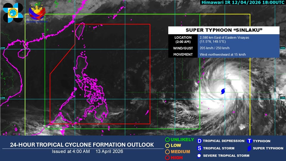
In its 4 a.m. public weather forecast on Monday, the state weather bureau said the super typhoon was estimated to be 2,580 kilometers east of Visayas as of 2 a.m. Monday.
It is packing 205 km/h winds and gusts of up to 250 km/h, and is moving west northwestward at 15 km/h.
On Sunday evening, the state weather bureau said Sinlaku developed into a super typhoon and is within is monitoring domain.
PAGASA said fair weather is expected over the next three days with low chances of rain due to the ridge of a high pressure area (HPA) extending over Luzon.
Metro Manila and the rest of the country will experience partly cloudy to cloudy skies with isolated rainshowers or thunderstorms due to localized thunderstorms.
Northern Luzon, Visayas and the rest of Luzon, and Mindanao will have light to moderate winds and slight to moderate seas.
Sunrise on Monday, April 13 is at 5:44 a.m. and sunset is at 6:10 p.m. — JMA, GMA News
