

Localized thunderstorms to bring rain in parts of PH; Sinlaku still outside PAR
Several areas in the country may see isolated rains in the next 24 hours due to localized thunderstorms, PAGASA said Wednesday afternoon as it continues to monitor Typhoon Sinlaku outside the Philippine Area of Responsibility.
According to its 4 p.m. weather forecast, the state weather bureau said localized thunderstorms will bring partly cloudy to cloudy skies with isolated rain showers or thunderstorms in Metro Manila and the rest of the country
PAGASA warned that severe thunderstorms may trigger flash floods or landslides.
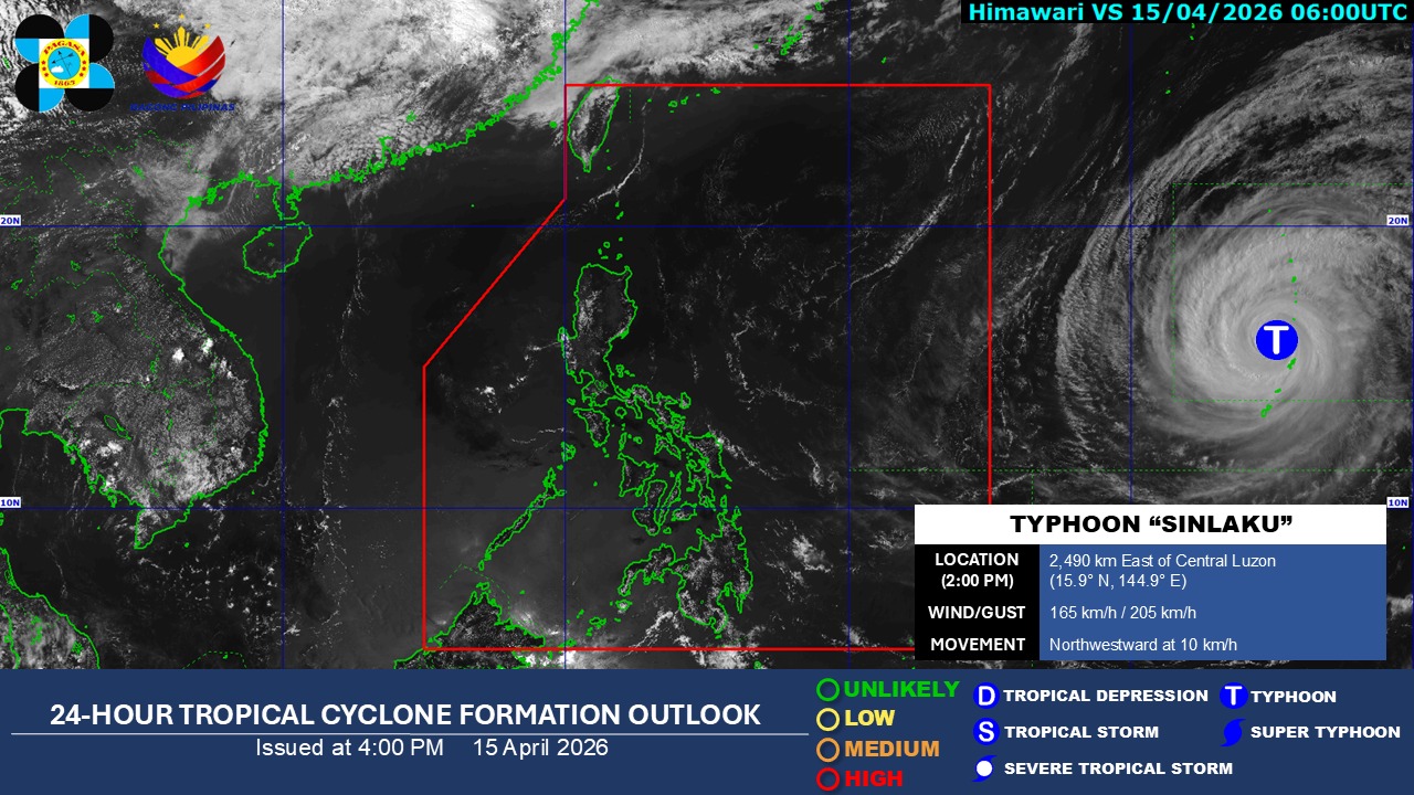
At 3 p.m., the Sinlaku was located 2,480 km east of Central Luzon in PAGASA’s Tropical Cyclone Information Domain (TCID).
It is carrying maximum sustained winds of 165 km/h near the center and gustiness of up to 205 km/h and moving northwestward at 10 km/h.
According to the PAGASA website, TCID is the agency's largest and outermost monitoring domain.
"Tropical cyclones present inside the TCID are of least concern for the forecasters but are necessary enough for monitoring and public awareness purposes," PAGASA said.
State meteorologists also said winds will be moderate to strong, while coastal waters will be moderate to rough in the eastern sections of Southern Luzon, Visayas, and Mindanao.
The rest of the country will experience light to moderate winds and slight to moderate coastal waters.
Sunrise in Metro Manila will be at 5:42 a.m. on Thursday. —Mariel Celine Serquiña/RF, GMA News
