

LPA enters PAR, but unlikely to become storm
A low pressure area (LPA) has entered the Philippine Area of Responsibility (PAR) and is “unlikely” to develop into a tropical depression within the next 24 hours, the state weather bureau said on Tuesday afternoon.
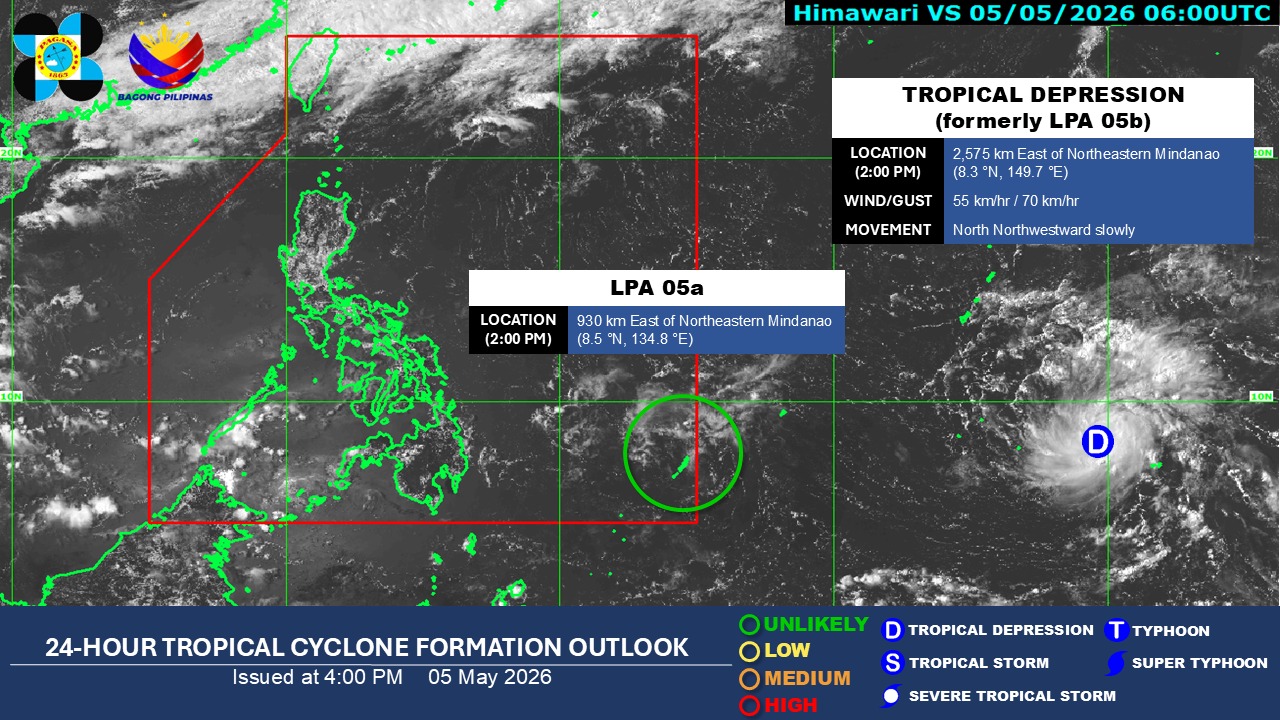
As of 2 p.m., PAGASA said LPA 05a was estimated to be 930 kilometers east of Northeastern Mindanao.
Meanwhile, the former LPA 05b monitored outside the PAR has already developed into a tropical depression.
As of 3 p.m., it was located 2,560 km east of Northeastern Mindanao and is packing maximum sustained winds of 55 km/h near the center, gustiness of up to 70 km/h, and is slowly moving north northwestward.
For now, PAGASA said the easterlies will affect the country, according to its 4 p.m. public weather forecast.
Palawan will see cloudy skies with scattered rains and thunderstorms due to the easterlies.
Partly cloudy to cloudy skies with isolated rain showers or thunderstorms will persist in Metro Manila and the rest of the country as a result of the easterlies.
The state weather bureau warned that these weather conditions may trigger flash floods or landslides.
Northern Luzon will experience moderate wind and coastal water conditions, while the rest of the country will experience light to moderate winds and slight to moderate seas.
Sunset today, Tuesday is at 6:14 p.m. while sunrise tomorrow, May 6 will be at 5:32 a.m. — JMA, GMA News
