

Hagupit becomes Caloy upon entering PAR, will weaken to tropical depression
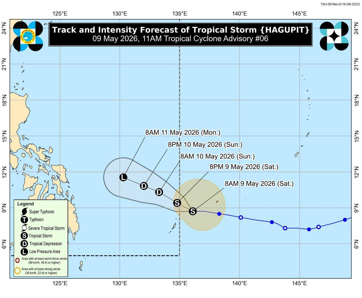
Tropical Storm Hagupit is expected to enter the Philippine Area of Responsibility (PAR) on Saturday and will be renamed Caloy, PAGASA said in its advisory.
However, it is expected to begin weakening on Sunday and become a tropical depression due to unfavorable environment, the state weather bureau said.
At 10 a.m. Saturday, the center of Hagupit was estimated to be located at 1,065 km east of Northeastern Mindanao, which is outside PAR.
The storm is packing maximum sustained winds of 65 km/h near the center, with gustiness of up to 80 km/h, and central pressure of 1002 hPa
Hagupit slightly weakened as it moves westward over the northeast of Palau at 20 km/h.
From its center, strong to gale-force winds are extending outwards up to 320 km.
"HAGUPIT is forecast to move west northwestward during the majority of the forecast period and will remain over the Philippine Sea, far from the Philippine landmass. It will enter the Philippine Area of Responsibility (PAR) today and will be given the local name CALOY," PAGASA said.
The storm may maintain its strength in the next 12 hours while moving over the Philippine Sea until it enters PAR, it added.
On Monday, it is expected to weaken further into a low pressure area.
"HAGUPIT is less likely to directly affect the weather and sea conditions in the next 48 hours," PAGASA said.
The weather bureau advised the public and disaster risk reduction and management offices concerned to monitor weather updates to be issued by PAGASA.
The next tropical cyclone advisory will be released at 11 p.m. unless there is an intermediate issuance. —KG, GMA News
