

Tropical cyclone Hagupit to enter PAR Saturday
Tropical cyclone Hagupit will enter the Philippine Area of Responsibility (PAR) on Saturday afternoon or evening and will be given the local name, Caloy, according to PAGASA on Friday evening.
"However, an earlier PAR entry is not ruled out," the state weather bureau said in its 11 p.m. tropical cyclone advisory.
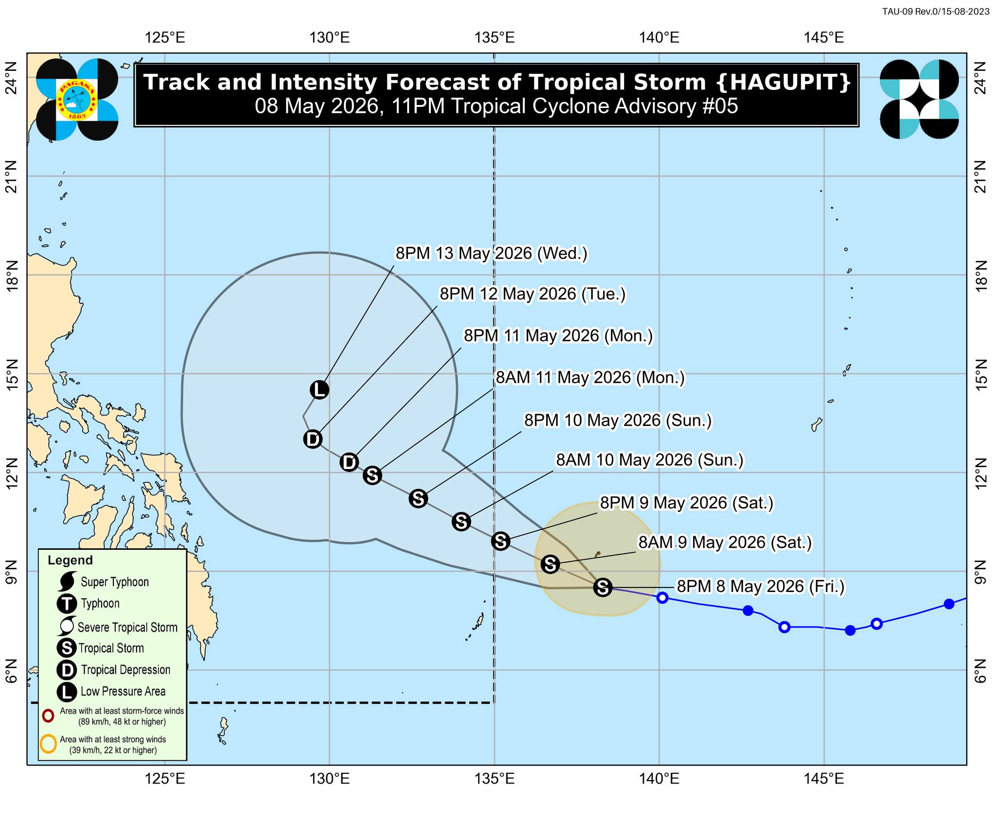
At 10 p.m., the center of the tropical storm was located 1,260 km east of northeastern Mindanao. Moving westward at 15 km/h, Hagupit has maximum sustained winds of 85 km/h near the center and gustiness of up to 105 km/h.
"In the next 12 hours, Hagupit may maintain its strength or briefly reach severe tropical storm category. However, it may begin weakening starting tomorrow (May 9) due to an unfavorable environment. Hagupit will be downgraded into a tropical depression on Monday (May 11) and become a low pressure area on Wednesday (May 13)," PAGASA said.
The storm is not expected to have a direct impact on the weather or sea conditions in the country over the next three days, it said.
"Hagupit is forecast to move west northwestward during the majority of the forecast period and will remain over the Philippine Sea, far from land," PAGASA said. — VBL, GMA News
