

Trough of LPA still affecting Mindanao on Monday - PAGASA
The trough of a low pressure area (LPA) affecting Mindanao will bring cloudy skies and scattered rains and thunderstorms to Mindanao and Palawan on Monday.
This is according to PAGASA’s 4 a.m. public weather forecast.
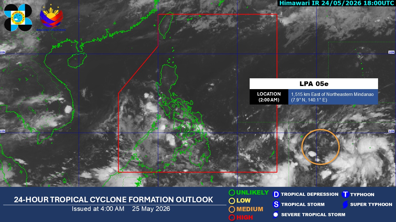
As of 2 a.m., the LPA (LPA 05e) is 1,515 kilometers east of Northeastern Mindanao outside the Philippine area of responsibility (PAR).
It has a medium chance of developing into a tropical depression within the next 24 hours.
Meanwhile, Bicol Region and Quezon will experience partly cloudy to cloudy skies with isolated rainshowers or thunderstorms due to the easterlies.
Metro Manila and the rest of the country will have partly cloudy to cloudy skies with isolated rainshowers or thunderstorms due to localized thunderstorms.
PAGASA warned of possible flash floods or landslides during moderate to heavy rains or severe thunderstorms in these areas.
Visayas, Mindanao, Palawan, Northern Luzon, and the rest of Luzon will have light to moderate winds and slight to moderate seas on Monday.
Sunrise on Monday, May 25, 2026 is at 5:27 a.m. while sunset is at 6:20 p.m. — JMA, GMA News
