

 GMA Brandtalk
 Tracking
 Archives

Domeng maintains strength, trough to affect parts of PH
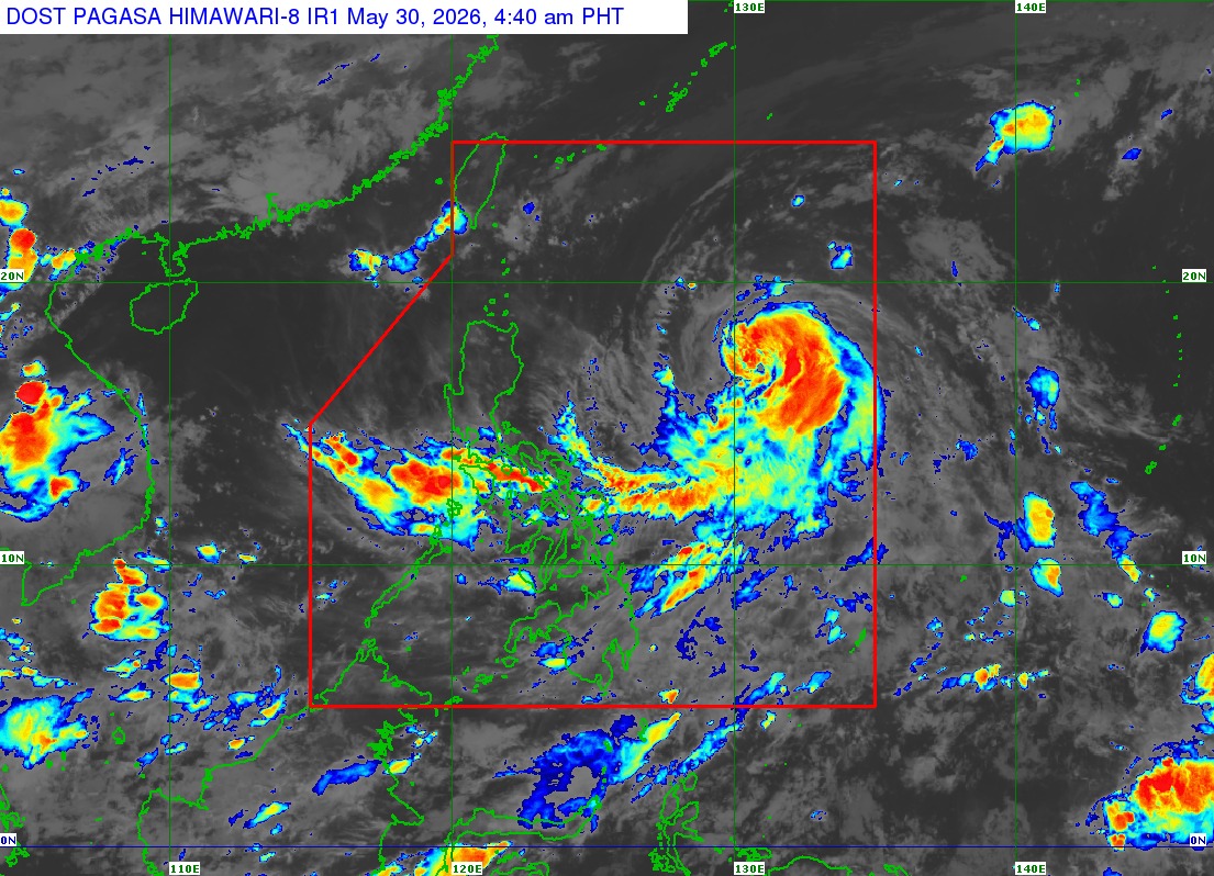
Several parts of the country will be affected by the trough of Severe Tropical Storm Domeng, which has maintained its strength while traversing the Philippine Sea, the state weather bureau PAGASA said early Saturday morning.
The Bicol Region, Batanes, Ilocos Norte, Apayao, Cagayan, Quezon, Northern Samar, Eastern Samar, and Samar will see cloudy skies with scattered rains and thunderstorms because of the trough of Domeng, which was located 970 km east of Northern Luzon as of 4 a.m.
It has maximum sustained winds of 95 km/h near the center and gustiness of up to 115 km/h.
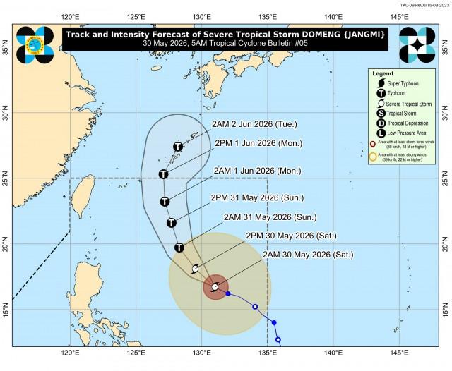
Domeng will move west northwestward at 15 km/h and is expected to reach typhoon category on Saturday night or Sunday morning while remaining over the Philippine Sea.
"Afterwards, it will steadily weaken but will remain as a typhoon throughout the rest of the forecast period," PAGASA said.
"This tropical cyclone is less likely to make landfall over the country. Domeng will likely exit the Philippine Area of Responsibility (PAR) by Monday, June 1."
In the next 24 hours, MIMAROPA, Western Visayas, Negros Island Region, Zamboanga Peninsula, SOCCSKSARGEN, BARMM, Batangas, and Lanao del Norte will experience cloudy skies with scattered rains and thunderstorms due to the southwesterly windflow.
Localized thunderstorms will prevail over Metro Manila and the rest of the country.
Winds will be moderate to strong and coastal waters will be moderate to rough in Northern Luzon.
The rest of the country will have light to moderate winds and slight to moderate coastal waters.
Sunrise in Metro Manila was at 5:26 a.m. Sunset is expected at 6:21 p.m. — VBL, GMA News

