

Wind signal lifted as Tropical Depression Ester nears PAR exit
PAGASA has lifted the wind signal over parts of Batanes as Tropical Depression Ester is expected to exit the Philippine Area of Responsibility (PAR) on Saturday morning.
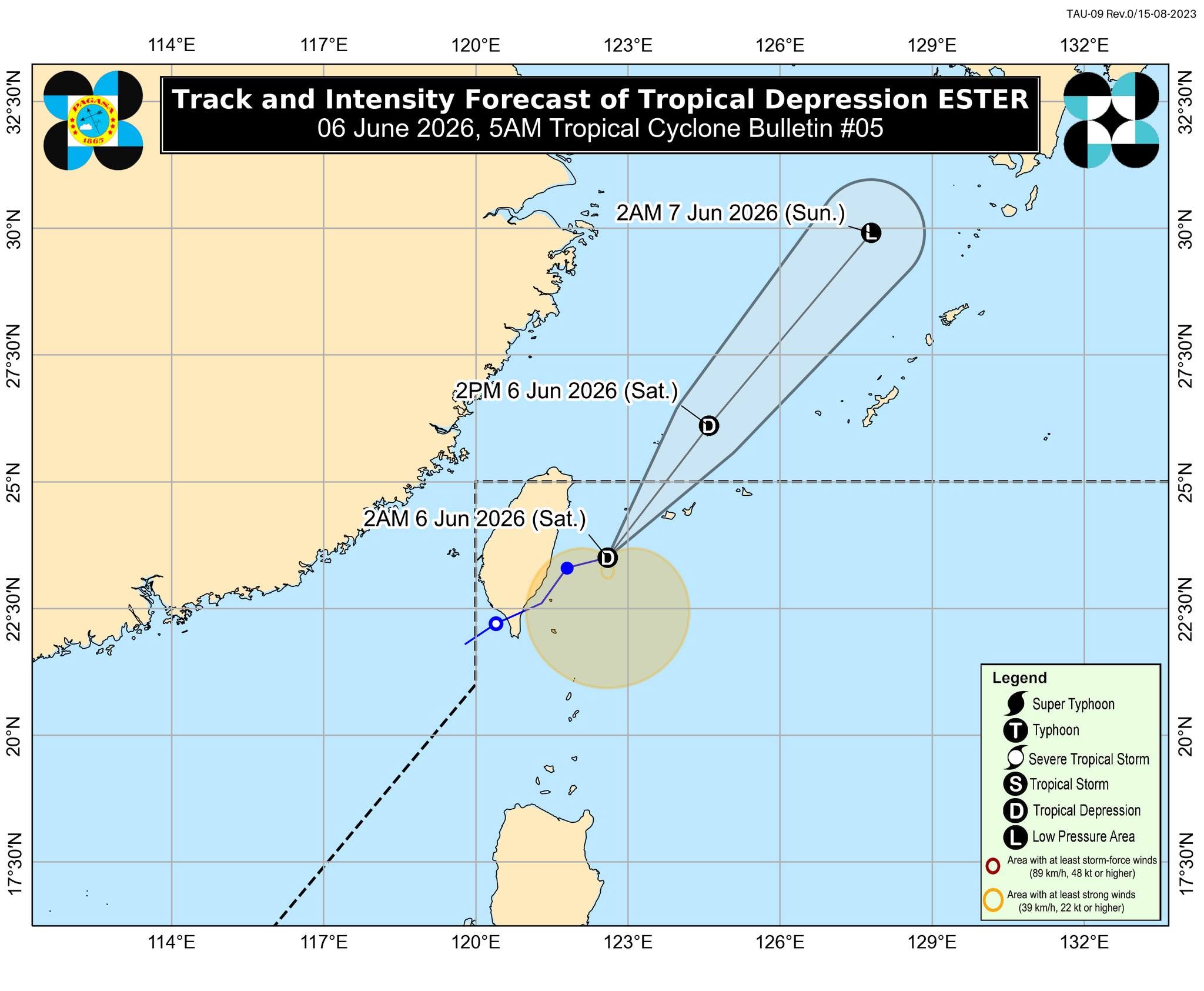
As of 4 a.m., Ester was located 380 kilometers north northeast of Itbayat, Batanes. It was carrying maximum sustained winds of 45 km/h near the center and gusts of up to 55 km/h while moving east-northeastward at 15 km/h.
Meanwhile, the Ilocos Region, Abra, Benguet, Zambales, and Bataan will experience occasional rains due to the Southwest Monsoon (Habagat). Metro Manila, Cagayan Valley, the rest of the Cordillera Administrative Region, the rest of Central Luzon, Rizal, Cavite, Batangas, and Occidental Mindoro will have cloudy skies with scattered rains and thunderstorms.
The rest of the country may expect isolated rain showers or thunderstorms due to localized thunderstorms.
The Southwest Monsoon will also bring strong to gale-force gusts, particularly in coastal and upland areas exposed to winds, over the following areas:
Saturday: Ilocos Region, Cordillera Administrative Region, and Cagayan Valley
Sunday: Batanes and the Babuyan Islands
"Tropical Depression Ester is forecast to move generally northeastward toward the East China Sea. It may exit the Philippine Area of Responsibility this morning. Ester will remain a tropical depression over the next 12 hours before transitioning into a post-tropical low tomorrow morning," PAGASA said in its 5 a.m. Saturday bulletin. — VBL, GMA News
