

Severe Tropical Storm Francisco enters PAR
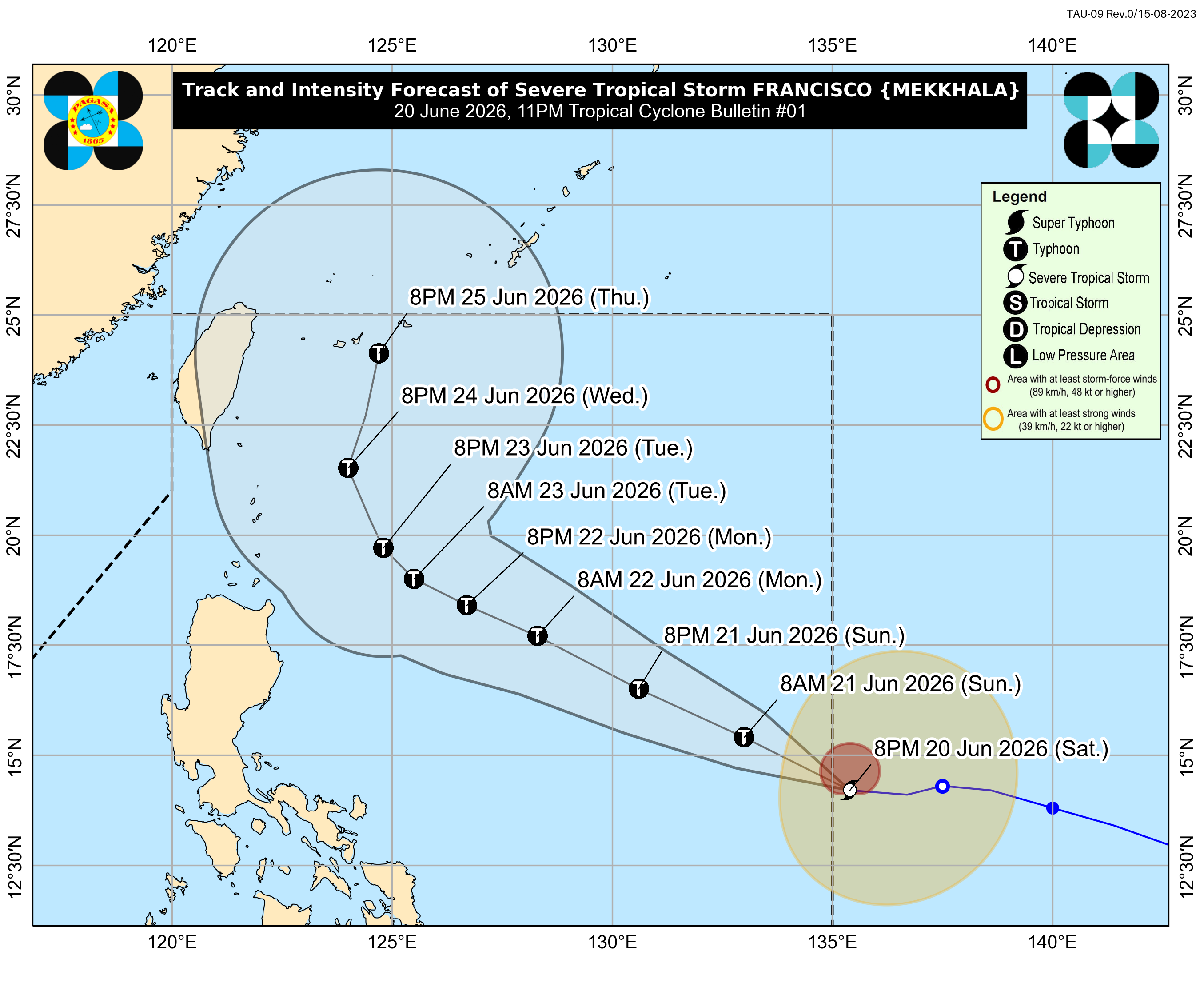
Severe Tropical Storm Francisco (international name: Mekkhala) entered the Philippine Area of Responsibility (PAR) at 10 p.m. on Saturday, the state weather bureau said.
In its 11 p.m. bulletin, the Philippine Atmospheric, Geophysical and Astronomical Services Administration (PAGASA) said the center of Francisco was estimated at 1,295 kilometers east of Southeastern Luzon, packing maximum sustained winds of 95 kph and gusts of up to 115 kph.
PAGASA said Francisco is forecast to continue intensifying and may reach typhoon category by Sunday, June 21. However, it is unlikely to directly affect the country’s weather conditions within the next 24 hours.
The weather bureau said the Southwest Monsoon, or Habagat, may bring strong to gale-force gusts over the following areas:
- Sunday (June 21): Siquijor, Camiguin, and the southern portions of Davao Oriental, Davao Occidental, and Sarangani
- Monday (June 22): Romblon, most of the Visayas, Zamboanga del Norte, Misamis Occidental, Lanao del Norte, Camiguin, Surigao del Norte, and Dinagat Islands
PAGASA added that the hoisting of Tropical Cyclone Wind Signal No. 1 over the northern and eastern portions of Northern Luzon remains possible.
In its 24-hour sea condition outlook, PAGASA said coastal waters along the eastern seaboards of Dinagat Islands, Siargao-Bucas Grande Islands, Surigao del Sur, and Davao Oriental may reach up to two meters.
Mariners of motor bancas and similarly sized vessels were advised to take precautionary measures while at sea and, if possible, avoid navigation.
PAGASA also urged the public and local disaster risk reduction and management offices to take all necessary measures to protect life and property.—MCG, GMA News
