

Typhoon Francisco slightly weakens, slows down; Signal No. 1 still up
Typhoon Francisco has slightly weakened on Tuesday night as it slowed down over the sea east of Extreme Northern Luzon, the state weather bureau said.
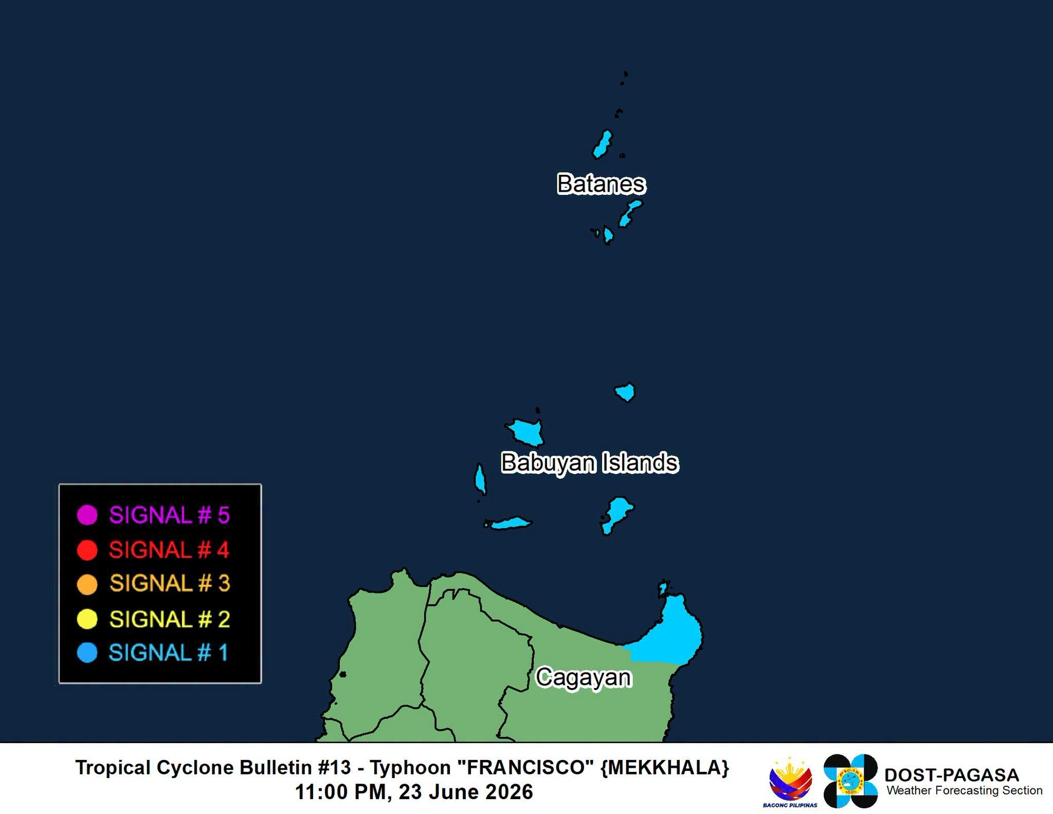
In its 11 p.m. tropical cyclone bulletin, PAGASA said Signal No. 1 remains in effect over these areas:
- Batanes, and
- The northeastern portion of Cagayan (Gonzaga, Santa Ana) including Babuyan Islands.
The typhoon’s center was estimated to be 320 km east of Calayan, Cagayan as of 10 p.m. of Tuesday, June 23.
It is has maximum sustained winds of 165 km/h near the center, gustiness of up to 205 km/h, and central pressure of 945 hPa and is moving slowly northward.
PAGASA said Typhoon Francisco is now beginning to move northward based on the latest forecast track and that the hoisting of Signal No.2 is now becoming less likely.
The weather disturbance will remain far from the Philippine landmass and is expected to gradually weaken, although it will remain a typhoon while inside the Philippine Area of Responsibility (PAR).
It will move northward on Tuesday night until Wednesday, June 24 before turning north northeastward, then northeastward from Wednesday afternoon onwards towards the Ryukyu Islands and sea south of mainland Japan.
Typhoon Francisco will exit the PAR on Thursday evening, June 25 or Friday morning, June 26.
However, the Southwest Monsoon and the periphery of the typhoon will bring strong to gale-force gusts over these areas:
Tuesday, June 23:
- Most of Luzon,
- Visayas,
- Zamboanga Peninsula,
- Northern Mindanao,
- Dinagat Islands,
- Davao Occidental, and
- Davao Oriental.
Wednesday, June 24:
- Most of Luzon,
- Visayas,
- Misamis Occidental,
- Lanao del Norte,
- Camiguin,
- Dinagat Islands,
- Davao Occidental, and
- Davao Oriental.
The state weather bureau warned of very rough seas of up to 4.5 meters over the eastern seaboards of Batanes and Babuyan Islands and the northeastern seaboard of mainland Cagayan.
“Sea travel is risky for all types or tonnage of vessels. All mariners must remain in port or, if underway, seek shelter or safe harbor as soon as possible until winds and waves subside,” it added. — JMA, GMA News
