

Rains expected as PAGASA monitors two cyclones inside and outside PAR
Rains are expected to dampen many areas in the country as PAGASA keeps watch over two cyclones within and outside the Philippine Area of Responsibility (PAR).
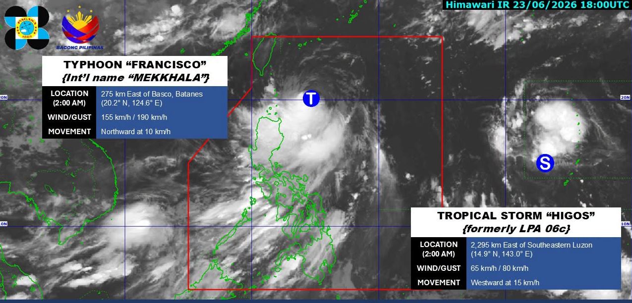
As of 3 a.m. Wednesday, the center of Typhoon Francisco was estimated at 350 kilometers East Northeast of Calayan, Cagayan or 275 km East of Basco, Batanes. It packs maximum sustained winds of 155 km/h near the center and gustiness of up to 190 km/h. It is moving northward at 10 km/h.
Meanwhile, Tropical Storm Higos, which remains outside PAR, was estimated at 2,285 km East of Southeastern Luzon, with maximum sustained winds of 65 km/h and gustiness of up to 80 km/h. It is moving westward at 15 km/h.
Francisco is expected to bring rains with gusty winds in Batanes and Babuyan Islands, which triggers the warning of possible flooding or landslides.
Ilocos Region, Cordillera Administrative Region, and the rest of Cagayan Valley will have cloudy skies with scattered rains and thunderstorms also due to the typhoon
Metro Manila, Central Luzon, CALABARZON, MIMAROPA, Bicol Region, Western Visayas, and Negros Island Region will experience cloudy skies with scattered rains and thunderstorms as a result of the Southwest Monsoon.
The rest of Visayas will have partly cloudy to cloudy skies with isolated rainshowers or thunderstorms brought about by the Southwest Monsoon.
Mindanao will see partly cloudy to cloudy skies with isolated rainshowers or thunderstorms due to localized thunderstorms.
Sunrise is at 5:29 a.m. and sunset is at 6:28 p.m. —LDF, GMA News
