

Tropical Storm Higos maintains strength; to enter PAR as Gardo by Thursday
Tropical Storm Higos maintained its strength and will be given the local name “Gardo” once it enters the Philippine Area of Responsibility (PAR) by Thursday evening, PAGASA said Wednesday.
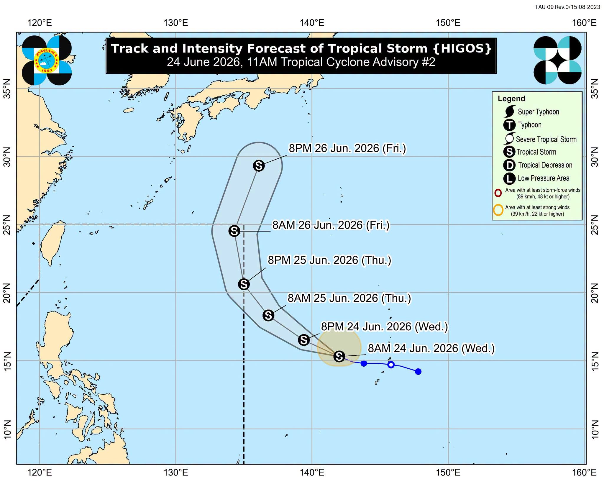
In an 11 a.m. advisory, PAGASA said Tropical Storm Higos is moving west northwestward near Guam.
It is forecast to move west northwestward to northwestward in the next 36 hours until it enters PAR.
While over the Philippine Sea, the tropical cyclone will turn generally northward and exit the PAR by Friday (June 26) morning or afternoon.
“This tropical cyclone is likely to remain as a tropical storm throughout the forecast period, although slight intensification into a severe tropical storm is not ruled out. Afterwards, it will gradually weaken while moving over the sea south of Japan,” PAGASA said.
“Higos will remain far from the Philippine landmass and is not expected to directly affect the weather and sea conditions throughout the forecast period,” it added.
As of 10 a.m., the center of the Tropical Storm Higos was estimated based on all available data at 2,120 km East of Central Luzon (OUTSIDE PAR) (15.5°N, 141.4°E).
It has maximum sustained winds of 65 km/h near the center, gustiness of up to 80 km/h, and central pressure of 1002 hPa.
Moving west northwestward at 20 km/h, it possesses strong to gale-force winds extending outwards up to 220 km from the center. —VAL, GMA News
