

Tropical Storm Higos to enter PAR on Thursday evening as Typhoon Francisco exits
A new tropical storm is poised to enter the Philippine Area of Responsibility (PAR) on Thursday evening as Typhoon Francisco exits the PAR, the state weather bureau said on Wednesday evening.
In its 11 p.m. tropical cyclone advisory, PAGASA said the tropical storm with international name Higos continued to move west northwestward over the sea of the Northern Mariana Islands, outside the PAR.
As of 10 p.m., the center of Higos was estimated to be 1,855 km east of Central Luzon outside the PAR.
It is packing maximum sustained winds of 65 km/h near the center with gustiness of up to 80 km/h and central pressure of 1002 hPa.
The tropical storm is moving west northwestward at 20 km/h and is forecast to move west northwestward to northwestward in the next 36 hours until it enters the PAR by Thursday evening, June 25, or early Friday morning, June 26.
PAGASA said the tropical storm will be given the local name Gardo once inside the PAR.
“While over the Philippine Sea, it will turn generally northward and exit the PAR by Friday morning or afternoon,” the state weather bureau said.
Higos is likely to remain as a tropical storm until Thursday and will likely weaken into a tropical depression by Friday.
The state weather bureau added that it will “remain far from the Philippine landmass and is not expected to directly affect the weather and sea conditions throughout the forecast period.”
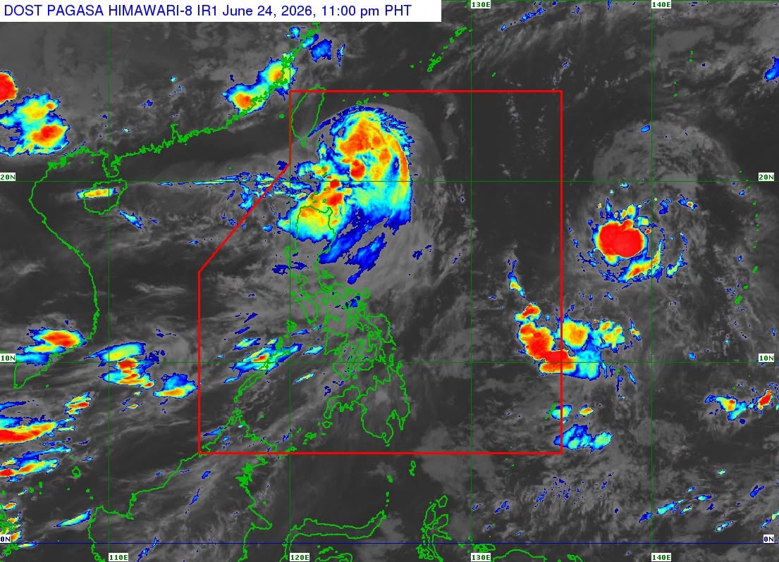
Meanwhile, Typhoon Francisco was estimated to be 325 km east northeast of Itbayat, Batanes as of 10 p.m. Wednesday, according to PAGASA’s 11 p.m. tropical cyclone bulletin.
Signal No. 1 remains in effect over Batanes as a result of the typhoon, which continued to weaken while moving slowly over the Philippine Sea.
Typhoon Francisco has maximum sustained winds of 120 km/h near the center, gustiness of up to 150 km/h, and central pressure of 975 hPa and is moving northward slowly.
The state weather bureau said the typhoon will begin turning north northeastward towards the Ryukyu Islands and sea south of mainland Japan.
It is forecast to weaken into a severe tropical storm within the next 12 hours and will continue to gradually weaken.
Typhoon Francisco is poised to exit the PAR by Thursday afternoon or evening. — JMA, GMA News
