

 GMA Brandtalk
 Tracking
 Archives

Super Typhoon Inday slightly intensifies, Signal No. 1 raised in 12 areas
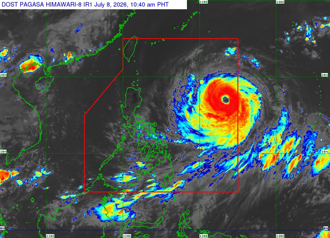
Super Typhoon Inday slightly intensified Wednesday morning as it moves west northwestward over the Philippine Sea east of Northern Luzon, according to PAGASA'S 11 am advisory.
Inday was last spotted 1,270 kilometers east of Northern Luzon, packing maximum sustained winds of 195 kph near the center, gusts of up to 240 kph, and a central pressure of 920 hPa.
Tropical Cyclone Wind Signal (TCWS) No. 1 has been raised in the following areas:
- Batanes
- Cagayan, including the Babuyan Islands
- Apayao
- Kalinga
- Isabela
- Northern portion of Aurora (Dilasag, Casiguran)
- Northern and central portions of Catanduanes
- Northeastern portion of Quirino
- Eastern portion of Ifugao
- Ilocos Norte
- Eastern portion of Mountain Province
- Northern portion of Abra
PAGASA said the highest wind signal that may be raised during Inday’s passage is Signal No. 2 or Signal No. 3.
While Inday is expected to maintain its strength as a super typhoon until Thursday, PAGASA said it may weaken into a typhoon by Thursday evening but is likely to remain a typhoon throughout the forecast period.
Meanwhile, the enhanced southwest monsoon or habagat and the typhoon’s outer circulation are expected to bring strong to gale-force gusts over Pangasinan, Zambales, Bataan, CALABARZON, most of MIMAROPA, the Bicol Region, most of the Visayas, and most of Mindanao on Wednesday.
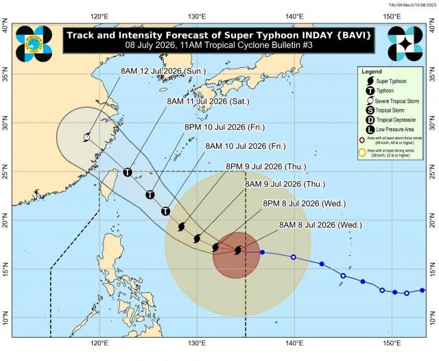
Inday is forecast to continue moving generally west northwestward over the next 24 hours before turning northwestward while remaining over the Philippine Sea.
By Thursday and Friday, strong to gale-force gusts may affect most parts of the country, PAGASA said.
The weather bureau also warned of very rough seas of up to 4.5 meters along the seaboards of Isabela, northern Aurora, northern and eastern Catanduanes, and eastern Northern Samar, where sea travel is considered risky for all types of vessels.
A gale warning remains in effect over the eastern seaboards of Northern and Central Luzon and the Visayas.
PAGASA said Inday may pass closest to Extreme Northern Luzon on Friday, July 10, before heading toward the southern islands of Japan and the waters north of Taiwan.
The typhoon is expected to exit the Philippine Area of Responsibility on Saturday, July 11. —VAL, GMA News

