

 GMA Brandtalk
 Tracking
 Archives

ADVERTISEMENT
Filtered By: Weather
Weather
Typhoon Inday weakens further, moves towards sea east of Taiwan
+
Make this your preferred source to get more updates from this publisher on Google.
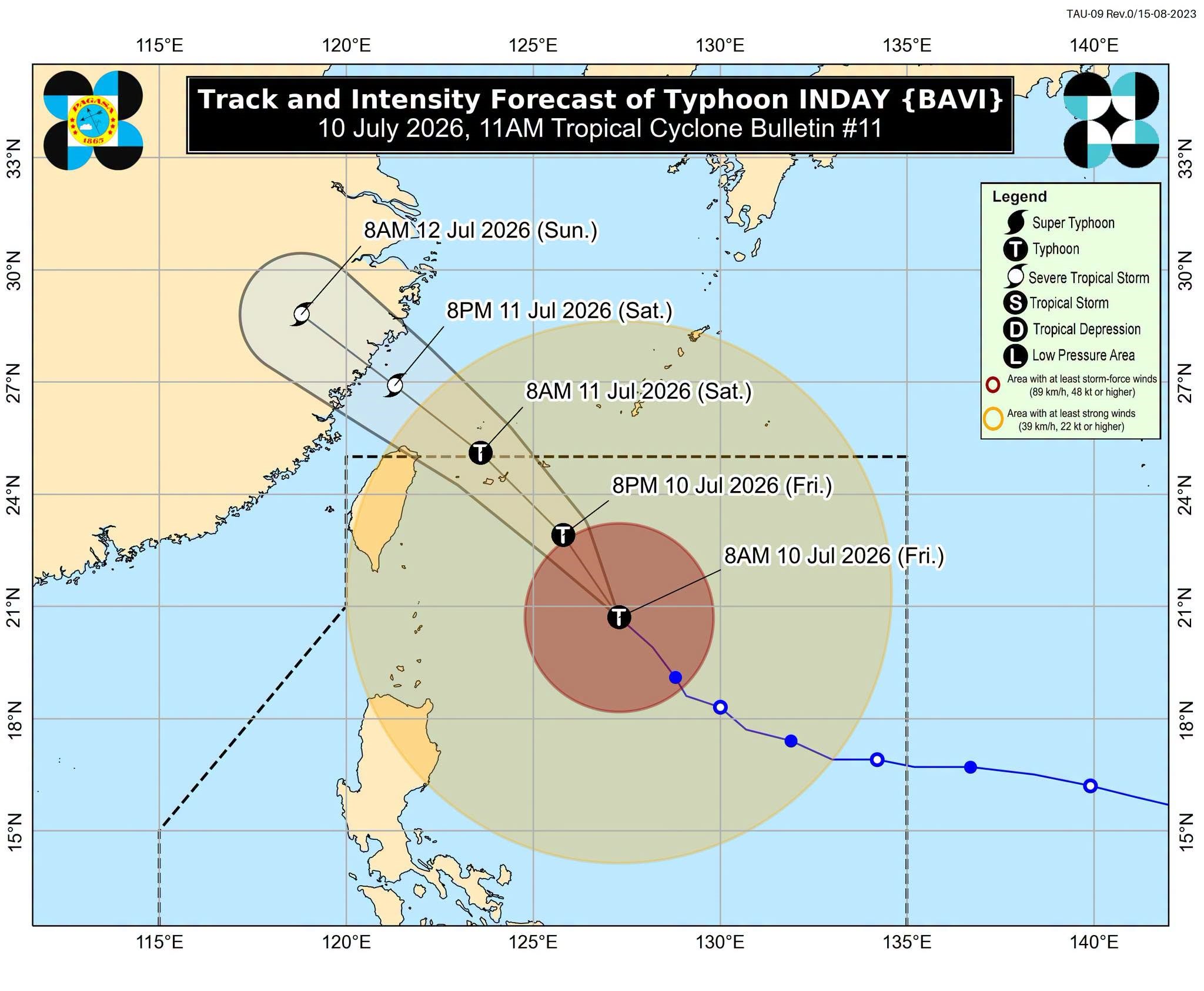
Typhoon Inday (international name: Bavi) continues to weaken as it moves northeast towards the sea east of Taiwan, state weather bureau PAGASA said Friday.
As of 10 a.m., Typhoon Inday was still inside the Philippine Area of Responsibility (PAR), estimated at 570 km east of Itbayat, Batanes. It carried maximum sustained winds of 140 kph and gusts up to 170 kph.
Tropical cyclone wind signals were raised in the following areas:
- Signal No. 2 — Batanes, east portion of Babuyan Islands, northeastern portion of mainland Cagayan
- Signal No. 1 — The rest of Babuyan Islands, rest of mainland Cagayan, Isabela, Apayao, northern portion of Abra, Kalinga, eastern portion of Mountain Province, eastern portion of Ifugao, and Ilocos Norte
The periphery of the typhoon and the enhanced Southwest Monsoon or Habagat are forecast to bring strong to gale-force gusts over the following areas:
- Friday to Saturday (July 10 and 11) — Most of the country
- Sunday (July 12) — Most of Luzon, most of Visayas, Zamboanga del Norte, Misamis Occidental, Lanao del Norte, Camiguin, and Davao Oriental
PAGASA said the typhoon is expected to remain as a typhoon until it exits PAR by Saturday morning or afternoon. — VDV, GMA News

