

 GMA Brandtalk
 Tracking
 Archives

Habagat to bring rains over Metro Manila, parts of Luzon, Visayas
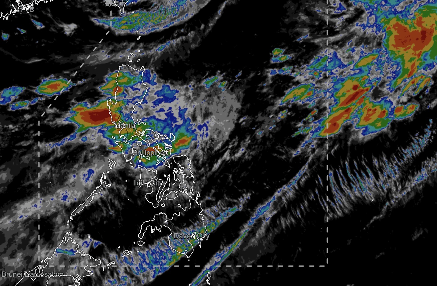
The Southwest Monsoon, or Habagat, will continue to bring rains over Metro Manila and several parts of Luzon and the Visayas on Sunday, the Philippine Atmospheric, Geophysical and Astronomical Services Administration (PAGASA) said.
In its 4 a.m. weather forecast, PAGASA said monsoon rains are expected over Ilocos Sur, La Union, Abra, Benguet, Zambales, Bataan, and Occidental Mindoro.
Moderate to heavy rains, which may become intense at times, could trigger flash floods or landslides in these areas, the state weather bureau said.
Meanwhile, Metro Manila, the rest of the Ilocos Region and Cordillera Administrative Region, Nueva Vizcaya, Tarlac, Nueva Ecija, Pampanga, Bulacan, Rizal, Cavite, Batangas, Oriental Mindoro, and Antique will experience occasional rains due to the Habagat.
PAGASA warned of possible flash floods or landslides due to moderate to heavy rains.
The Negros Island Region, Central Visayas, the rest of Luzon, Leyte, and Southern Leyte will have cloudy skies with scattered rains and thunderstorms, also due to the Habagat.
Batanes will likewise experience cloudy skies with scattered rains and thunderstorms due to the trough of Typhoon Dolphin, which remains outside the Philippine Area of Responsibility (PAR).
As of 3 a.m., Dolphin was located 755 kilometers north northeast of Itbayat, Batanes, packing maximum sustained winds of 130 kilometers per hour near the center and gustiness of up to 160 km/h.
The typhoon was moving west-northwestward at 15 km/h.
PAGASA was also monitoring two tropical depressions outside PAR.
One was located 3,435 km east of Extreme Northern Luzon, with maximum sustained winds of 45 km/h and gustiness of up to 55 km/h. It was moving east northeastward at 40 km/h.
The other tropical depression was spotted 1,980 km east of extreme Northern Luzon, also packing maximum sustained winds of 45 km/h and gustiness of up to 55 km/h. It was moving east-southeastward at 20 km/h.
Meanwhile, Mindanao will have partly cloudy to cloudy skies with isolated rain showers or thunderstorms due to localized thunderstorms.
Strong to gale-force winds are expected over extreme Northern Luzon, where coastal waters will be rough to very rough, with waves reaching 2.6 to 4.5 meters.
The rest of Luzon will have moderate to strong southwest winds and moderate to rough seas of 1.5 to 3.5 meters, PAGASA said.
Moderate to strong winds from the south to southwest will prevail over the Visayas and Mindanao, with wave heights ranging from 1.2 to 3 meters.
PAGASA said the sun will rise over Metro Manila at 5:42 a.m. and set at 6:18 p.m. — MCG, GMA News

