

 GMA Brandtalk
 Tracking
 Archives

LPA outside PAR has 'high chance' of developing into tropical depression — PAGASA
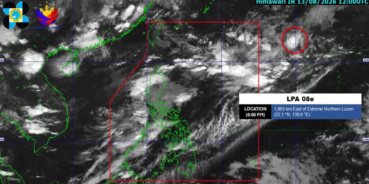
A Low Pressure Area (LPA) located outside the Philippine Area of Responsibility (PAR) has a high chance of developing into a tropical depression with the next 24 hours, PAGASA reported.
The LPA, named LPA 08e, is located 1,865 kilometers east of extreme Northern Luzon as of 8 p.m. on Thursday, August 13, 2026.
The public is advised to monitor updates regularly posted by the state weather bureau, PAGASA.
Earlier, PAGASA reported in its afternoon forecast that the southwest monsoon or habagat will be affecting Luzon and the western section of Visayas.
Zambales, Bataan, and Occidental Mindoro will have occasional rains due to the southwest monsoon with flash floods or landslides possibly occurring due to moderate to heavy rains.
Metro Manila, Ilocos Region, Cordillera Administrative Region, Cagayan Valley, CALABARZON, the rest of MIMAROPA, the rest of Central Luzon, Camarines Norte, Aklan, Antique, and Capiz will have cloudy skies with scattered rains and thunderstorm due to the southwest monsoon with flash floods or landslides likely to occur due to moderate to at times heavy rains.
The rest of Luzon will have partly cloudy to cloudy skies with isolated rain showers or thunderstorms due to the southwest monsoon while flash floods or landslides may occur during severe thunderstorms.
The rest of the country will have partly cloudy to cloudy skies with isolated rain showers or thunderstorms due to localized thunderstorms while flash floods or landslides may occur during severe thunderstorms. — BAP, GMA News

