

 GMA Brandtalk
 Tracking
 Archives

TD Neneng maintains strength, pulls in Habagat —PAGASA
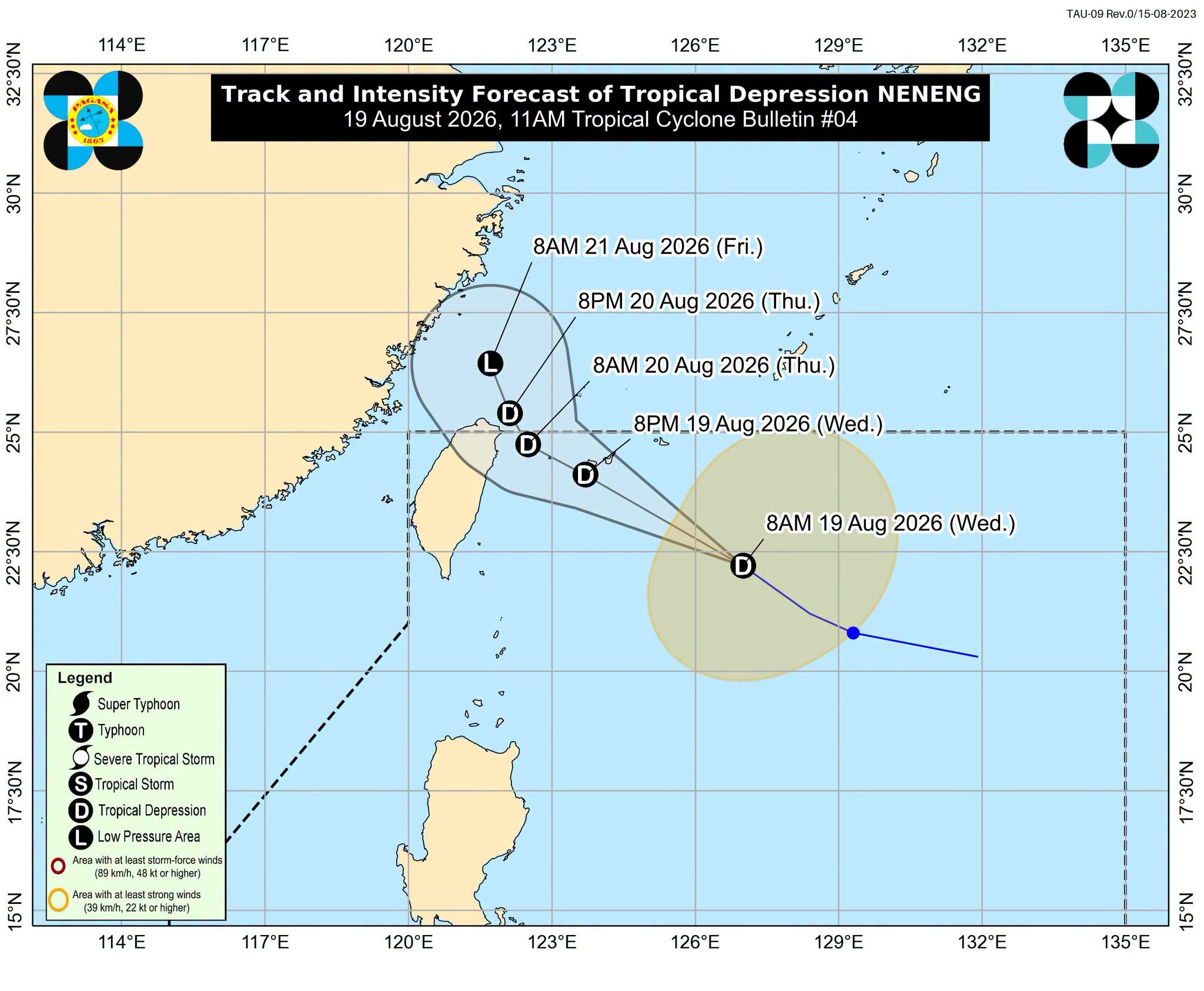
Tropical Depression Neneng has maintained its strength on Wednesday as it moves northwestward and is forecasted to intensify the weeks-long Southwest Monsoon in several areas, state weather bureau PAGASA said.
In its 11 a.m. bulletin, PAGASA said Neneng is moving over the sea east of Southern Taiwan.
As of 10 a.m., the center of Neneng was located 530 kilometers east northeast of Itbayat, Batanes. It is moving northwestward at 30 km/h. It has maximum sustained winds of 55 km/h near the center and gustiness of up to 70 km/h.
PAGASA weather specialist Benison Estareja said Neneng will not directly impact the country but will pull in Habagat.
“Yung mga pag-ulan na ating nararanasan sa Luzon at western section ng Visayas ay dahil pa rin sa Southwest Monsoon or hanging Habagat na siya pong bahagyang hinihila nitong si bagyong Neneng,” he said.
(The rain we are experiencing in Luzon and the western section of Visayas is because of the southwest monsoon that is partially being pulled by cyclone Neneng.)
Because Neneng is lifting the southwest monsoon, the rains will most likely be concentrated in the west of Central Luzon and Pangasinan, Estareja said. Those areas are expected to experience stronger rains.
PAGASA said that Neneng will move generally west northwestward and may pass close or make landfall over the northern coast of Taiwan by Thursday afternoon or evening.
It added that the center of Neneng will remain over the Philippine Sea throughout the forecast period.
The state weather bureau further said that Neneng will remain a tropical depression in the next 36 hours before weakening into a remnant low over or near Taiwan on Friday morning. However, earlier weakening into a remnant low is not ruled out. —AOL, GMA News

