

 GMA Brandtalk
 Tracking
 Archives

Heavy rains expected over parts of Luzon due to Habagat
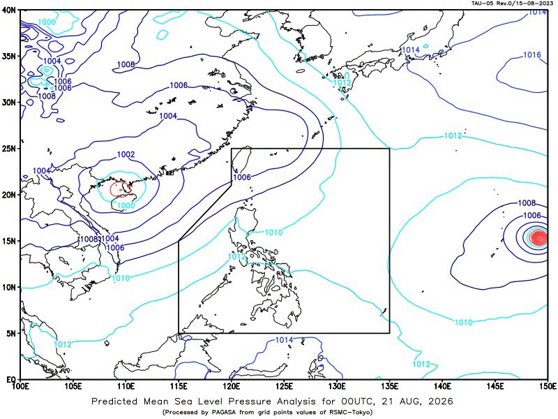
Heavy rains are expected over parts of Luzon on Friday as the Southwest Monsoon or Habagat continues to affect the region, state weather bureau PAGASA said.
In its 24-hour public weather forecast, PAGASA said Ilocos Norte, Ilocos Sur, Apayao, Abra, Batanes, and Cagayan will experience cloudy skies with scattered rains and thunderstorms due to Habagat.
Moderate to at times heavy rains in these areas may trigger flash floods or landslides, PAGASA said.
Meanwhile, Metro Manila and the rest of Luzon will have partly cloudy to cloudy skies with isolated rainshowers or thunderstorms also due to Habagat.
PAGASA said severe thunderstorms may also lead to flash floods or landslides in the affected areas.
The rest of the country will experience partly cloudy to cloudy skies with isolated rainshowers or thunderstorms due to localized thunderstorms.
Flash floods or landslides during severe thunderstorms are possible in the affected areas, according to PAGASA.
Winds, coastal waters
Moderate to strong winds from the southwest are expected over the northern and western sections of Luzon, where coastal waters may be moderate to rough from 2.1 to 3.8 meters.
The rest of Luzon will have light to moderate southwest winds and slight to moderate seas with waves from 0.6 to 2.5 meters.
Meanwhile, the rest of the country will experience light to moderate winds from the south to southwest, with coastal waters at 0.6 to 2.1 meters.
PAGASA also monitored Severe Tropical Storm Saudel outside the Philippine area of responsibility as of 3 a.m.
Saudel was located 2,735 kilometers east of Eastern Visayas, packing maximum sustained winds of 95 kilometers per hour (kph) near the center and gustiness of up to 115 kph.
The severe tropical storm was moving north-northwestward at 25 kph, according to PAGASA. —VAL, GMA News

