
NDRRMC warns of more extensive damage as Rolly intensifies into super typhoon
Rolly is expected to cause more extensive damage as it intensified into a super typhoon Sunday morning, according to the National Disaster Risk Reduction and Management Council (NDRRMC).
Interviewed on Dobol B sa News TV on Sunday, NDRRMC administrator Undersecretary Ricardo Jalad advised residents in hazard prone areas to evacuate their homes already.
“Even bago maitaas sa kategoryang super typhoon itong si Rolly ay sinasabi natin na malawakang pinsala ang posibleng idudulot nitong si Rolly. At ngayon na naging super typhoon na siya ay lalo pang siguro ganun ang mangayayari,” Jalad said.
“Matinding pinsala ang dulot niyan sa mga punongkahoy nagtutumbahan, at nagliliparan ‘yung mga yero, mga putol na kahoy. And delikado 'yan sa ating kaligtasan at kapag tumama ‘yan sa ating katawan. Marami na tayong casualties dyan,” he added.
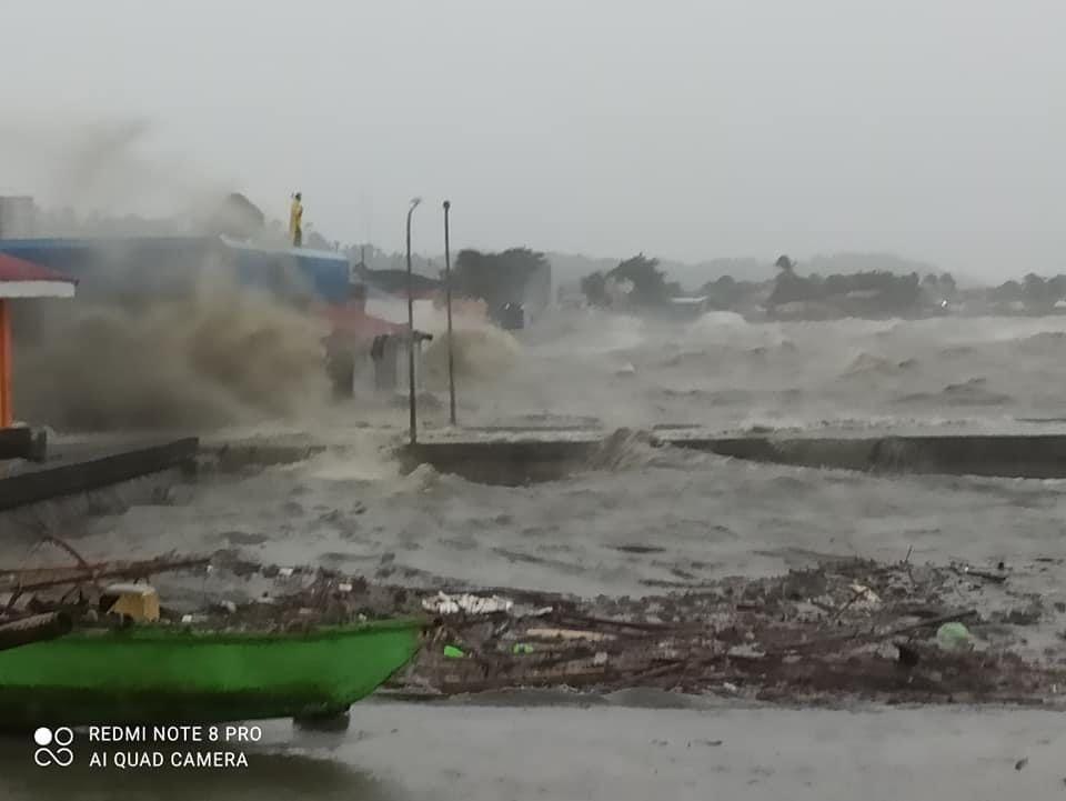
Rolly made landfall over the vicinity of Bato, Catanduanes at 4:50 a.m. on Sunday, weather bureau PAGASA said.
It has maximum sustained winds of 225 kilometers per hour and gustiness of up to 280 km/h, moving west southwestward at 25 km/h.
From Catanduanes, the center of Rolly will cross Lagonoy Gulf and make its second landfall either over the southern portion of Camarines Sur or the northern portion of Albay.
From there, Rolly will cross the Camarines Provinces then head for Calabarzon on Sunday afternoon, according to PAGASA.
Tropical Cyclone Wind Signals (TCWS) have been raised over different parts of the country due to Rolly. Signal No. 5 was hoisted over Catanduanes, Albay and the eastern portion of Camarines Sur.
Already, strong waves and winds are being felt in Quezon, Camarines Norte, Sorsogon and other areas. — Joviland Rita/RSJ, GMA News
