

Signal No. 3 still up in 2 areas as Neneng intensifies further moving westward
Tropical Cyclone Wind Signal (TCWS) No. 3 is still in effect over two areas as Severe Tropical Storm Neneng intensifies further, moving westward away from the Babuyan Islands in extreme Northern Luzon, state weather bureau PAGASA said Sunday.
In its 11 a.m. severe weather bulletin PAGASA said Signal No. 3 is still raised over:
- the southern portion of Batanes (Basco, Mahatao, Uyugan, Ivana, Sabtang), and
- Babuyan Islands
These areas are experiencing storm-force winds or may expect such weather condition within 18 hours. Winds may also lead to moderate to significant threat to life and property.
- Under Signal No. 2, meanwhile, were the following:
- the rest of Batanes
- the rest of Cagayan
- Apayao
- the northern portion of Abra (Tineg, Lacub, Lagayan)
- Ilocos Norte
Areas under Signal No. 2 are experiencing gale-force winds or may expect such condition in the next 24 hours. Winds may also lead to minor to moderate threat to life and property.
On the other hand, the following areas were under Signal No. 1:
- the northern and central portions of Isabela (Santa Maria, San Pablo, Maconacon, Divilacan, Palanan, Ilagan City, Tumauini, Cabagan, Santo Tomas, Quezon, Delfin Albano, Mallig, Quirino, Gamu, Roxas, San Mariano, Benito Soliven, Naguilian, Burgos, Reina Mercedes, San Manuel, Aurora, Luna, Cabatuan, San Mateo, Dinapigue, City of Cauayan)
- Kalinga
- the rest of Abra
- Mountain Province
- the northern portion of Ifugao (Aguinaldo, Alfonso Lista, Mayoyao, Hungduan, Banaue)
- the northern and central portions of Ilocos Sur (Sinait, Cabugao, San Juan, Magsingal, Santo Domingo, San Ildefonso, San Vicente, Santa Catalina, Bantay, City of Vigan, Santa, Caoayan, Narvacan, Nagbukel, Santa Maria, San Esteban, Santiago, Burgos, Banayoyo, Lidlidda, San Emilio, Quirino, Gregorio del Pilar, Galimuyod, City of Candon, Santa Lucia, Salcedo, Cervantes, Suyo, Sigay, Santa Cruz)
These areas have strong winds prevailing or expected within 36 hours. Winds may also result in minimal to minor threat to life and property.
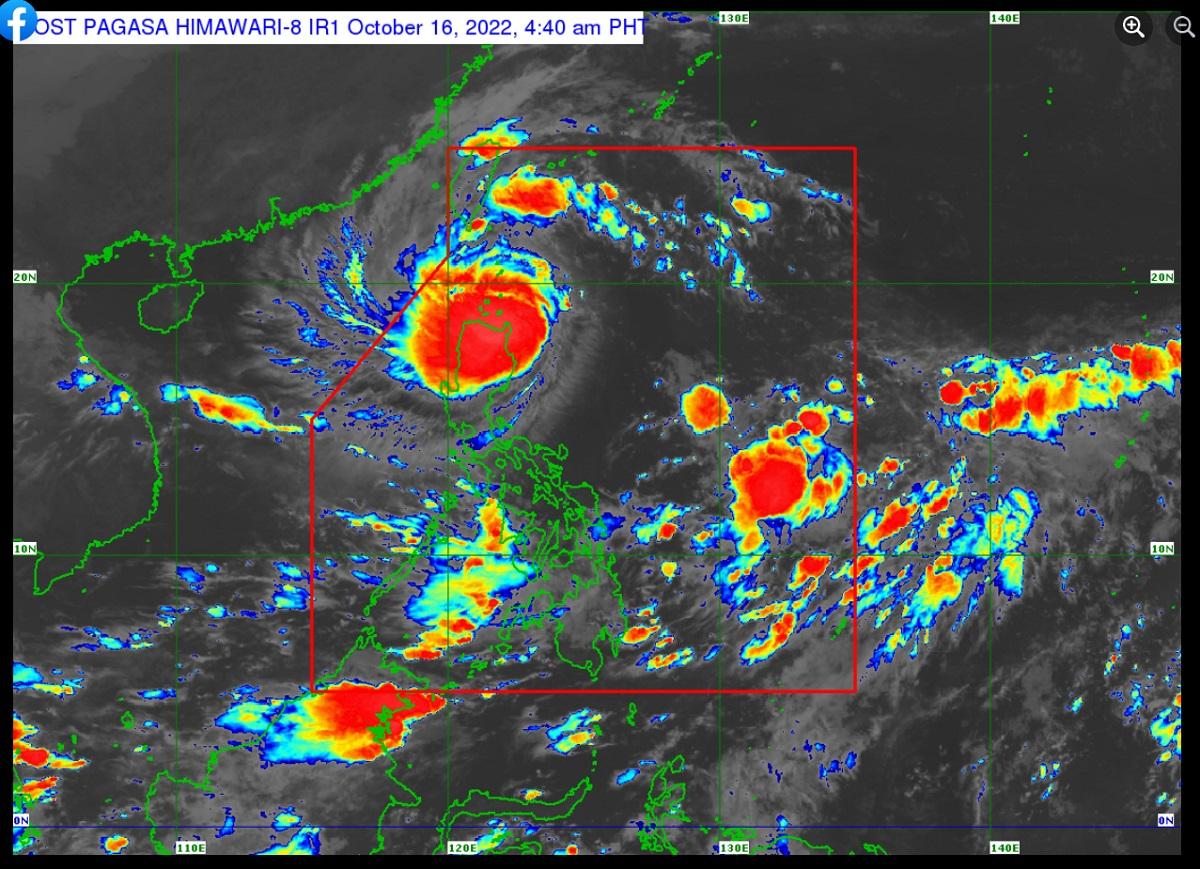
As of 10 a.m., the center of the eye of Neneng was estimated at 115 km west northwest of Calayan, Cagayan.
It had maximum sustained winds of 100 km/h near the center, gustiness of up to 125 km/h, and central pressure of 980 hPa.
At present, Neneng is moving west-northwestward at 25 kph.
It also has strong to storm-force winds that extend outwards up to 550 km from the center.
Heavy Rainfall
Moderate to heavy with at times intense rains will likely prevail over Apayao, Ilocos Norte, Ilocos Sur, and Babuyan Islands until this afternoon, the state weather bureau said.
Light to moderate with at times heavy rains are possible over Batanes, the northern portion of Cagayan, and the rest of Cordillera Administrative Region and Ilocos Region.
For the rest of the day, light to moderate with at times heavy rains will be experienced over Ilocos Norte and Ilocos Sur.
PAGASA said scattered to widespread flooding and rain-induced landslides may result in areas prone to these hazards.
Severe winds
During the passage of Neneng, PAGASA said that winds may reach storm-force strength over Babuyan Islands and southern Batanes, and winds of up to gale-force strength may prevail within any of the areas where Signal No. 2 is hoisted.
Moreover, strong winds (strong breeze to near gale strength) will be experienced within any of the areas where Signal No. 1 is currently in effect.
The induced southwesterly winds may also bring occasional gusts reaching strong breeze to near gale strength today over most of Southern Luzon and the Visayas and the eastern portions of Central Luzon, especially in coastal and mountainous/upland localities of these areas, PAGASA added.
Coastal waters
Marine gale warning remains in effect over the seaboards of Northern Luzon under the influence of the surge of northeasterly surface wind flow, PAGASA said.
The surge and the approaching tropical cyclone may also bring moderate to rough seas (2.0 to 3.5 m) over the eastern and western seaboards of Central Luzon and the eastern seaboard of Southern Luzon.
Track, intensity outlook
According to PAGASA, Neneng is expected to move westward or west-northwestward over the West Philippine Sea until early morning Monday, then turn and move generally west-southwestward or southwestward for the remainder of tomorrow through Wednesday morning.
On the forecast track, it may exit the Philippine Area of Responsibility (PAR) on Sunday afternoon or evening.
Neneng is also forecast to further intensify into a typhoon on Sunday afternoon or evening as it moves over the West Philippine Sea. —LBG, GMA News
