

 GMA Brandtalk
 Tracking
 Archives

Pilandok maintains strength; habagat to bring rains over Luzon, western Visayas
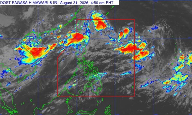
Tropical Depression Pilandok maintains its strength as it moves west northwestward as habagat is expected to bring rains over Luzon, western Visayas, PAGASA reported.
According to the 5 a.m. Tropical Cyclone Bulletin, the center of Tropical Depression Pilandok was estimated at 1,050 km east of Extreme Northern Luzon packing maximum sustained winds of 55 kilometers per hour near the center, gustiness of up to 70 km/h,and moving west northwestward at 10 km per hour.
There are no tropical cyclone wind signal raised.
The southwest monsoon (habagat) will bring cloudy skies with occasional rains over Luzon and he western section of the Visayas on Tuesday, PAGASA reported.
Heavy rainfall outlook due to Southwest Monsoon, 50-100 mm rainfall over Ilocos Norte, Ilocos Sur, La Union, Pangasinan, Batanes, Abra, Benguet, Zambales, and Bataan.
Severe Winds
The Southwest Monsoon will bring strong to gale-force gusts over the following areas (especially in coastal and upland areas exposed to winds) today until Thursday, September 3, 2026: Most of Luzon and Visayas, Zamboanga del Norte, Misamis Occidental, Lanao del Norte, Misamis Oriental, Camiguin, Dinagat Islands, Davao Occidental, and Davao Oriental.
Hazards affecting coastal waters
A Gale Warning is in effect over the northern and western seaboards of Northern Luzon.
Sea travel is risky, PAGASA said, adding that mariners must remain in port or, if underway, seek shelter or safe harbor as soon as possible until winds and waves subside.
Track and Intensity Outlook
Tropical Depression Pilandok is forecast to slowly turn east northeastward then northward over the next 24 hours then move generally north northwestward for the remainder of the forecast period.
Pilandok is forecast to exit the Philippine Area of Responsibility (PAR) by Wednesday evening, September 2, 2026 or Thursday morning.
"This tropical cyclone is less likely to make landfall over the country and will remain far from the Philippine landmass," the weather bureau said.
"Pilandok is forecast to intensify into a tropical storm within the next 12 hours and may remain as a tropical storm as it moves towards southern Japan," it added. — BAP, GMA News

