

 GMA Brandtalk
 Tracking
 Archives


Severe Tropical Storm Cempaka keeps strength as it nears PAR
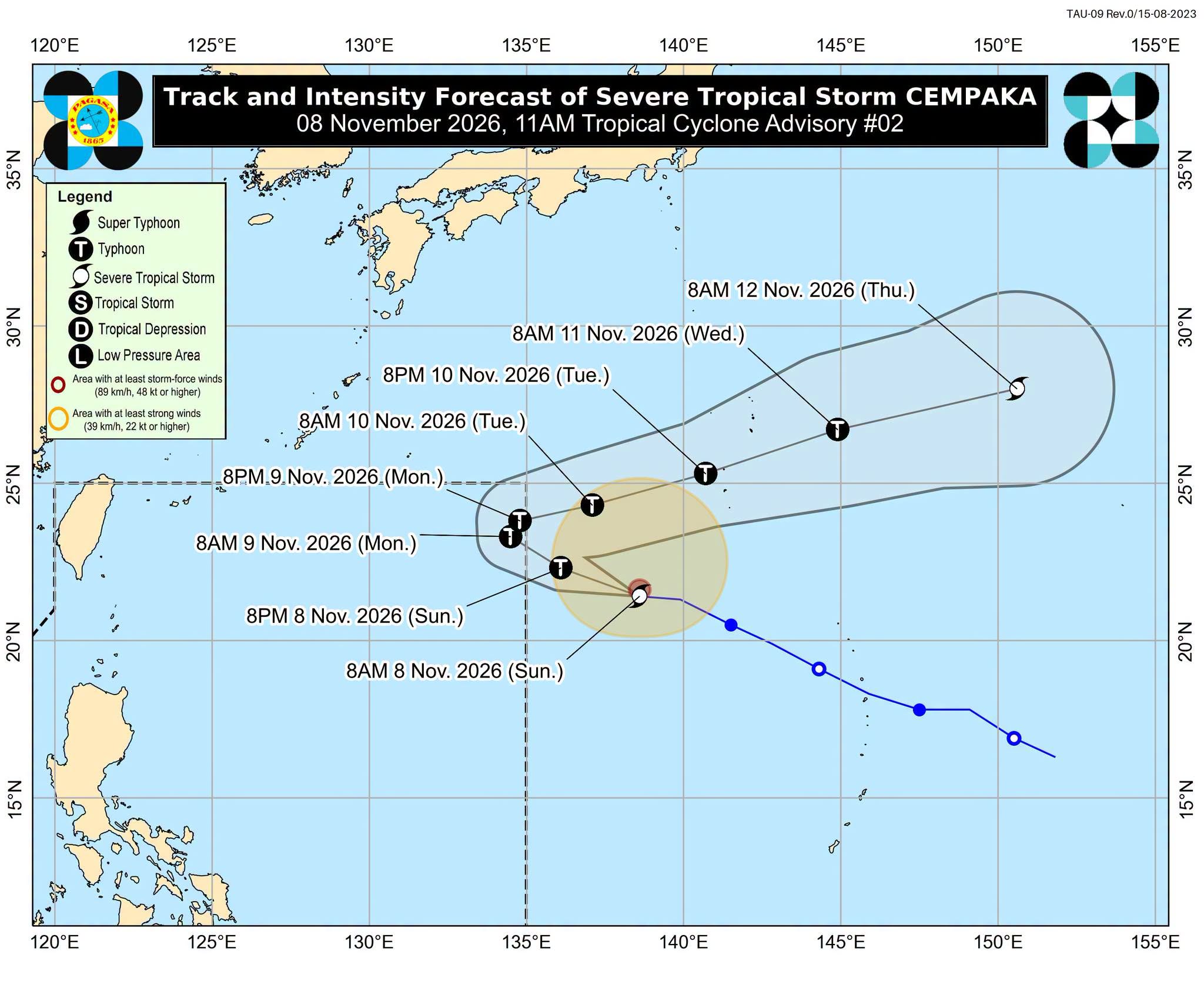
Severe Tropical Storm Cempaka maintained its strength while remaining outside the Philippine Area of Responsibility (PAR), state weather bureau PAGASA said Sunday.
According to the 11 a.m. tropical cyclone advisory, Cempaka was monitored 1,720 kilometers east of extreme northern Luzon.
The storm has maximum sustained winds of 110 kilometers per hour near the center, and gustiness of up to 135 kilometers per hour. It is moving westward at 25 kilometers per hour.
Cempaka is forecast to intensify into a typhoon today and will continue to strengthen until it reaches peak intensity. By Tuesday (10 November), a gradual weakening will likely to begin.
The severe tropical storm is expected to enter PAR either late Sunday evening or early Monday, November 9.
The storm will be assigned the local name “Samuel” once it enters PAR.
PAGASA said Cempaka will not directly affect the country.
"The TC will briefly stay inside the PAR, as it is forecast to begin to turn north northeastward by Monday afternoon or evening and exit through the northeastern boundary of the PAR," the state weather bureau said.
"The TC will remain over the Philippine Sea, far from land, and is not expected to directly affect the weather or sea conditions in the country. However, due to the Northeast Monsoon, moderate to rough seas will prevail over the seaboards of Northern and Central Luzon within the next 24 hours," PAGASA added. —Vince Angelo Ferreras/RF, GMA News

