

Basyang now a tropical storm, Signal No. 2 up in Surigao del Sur
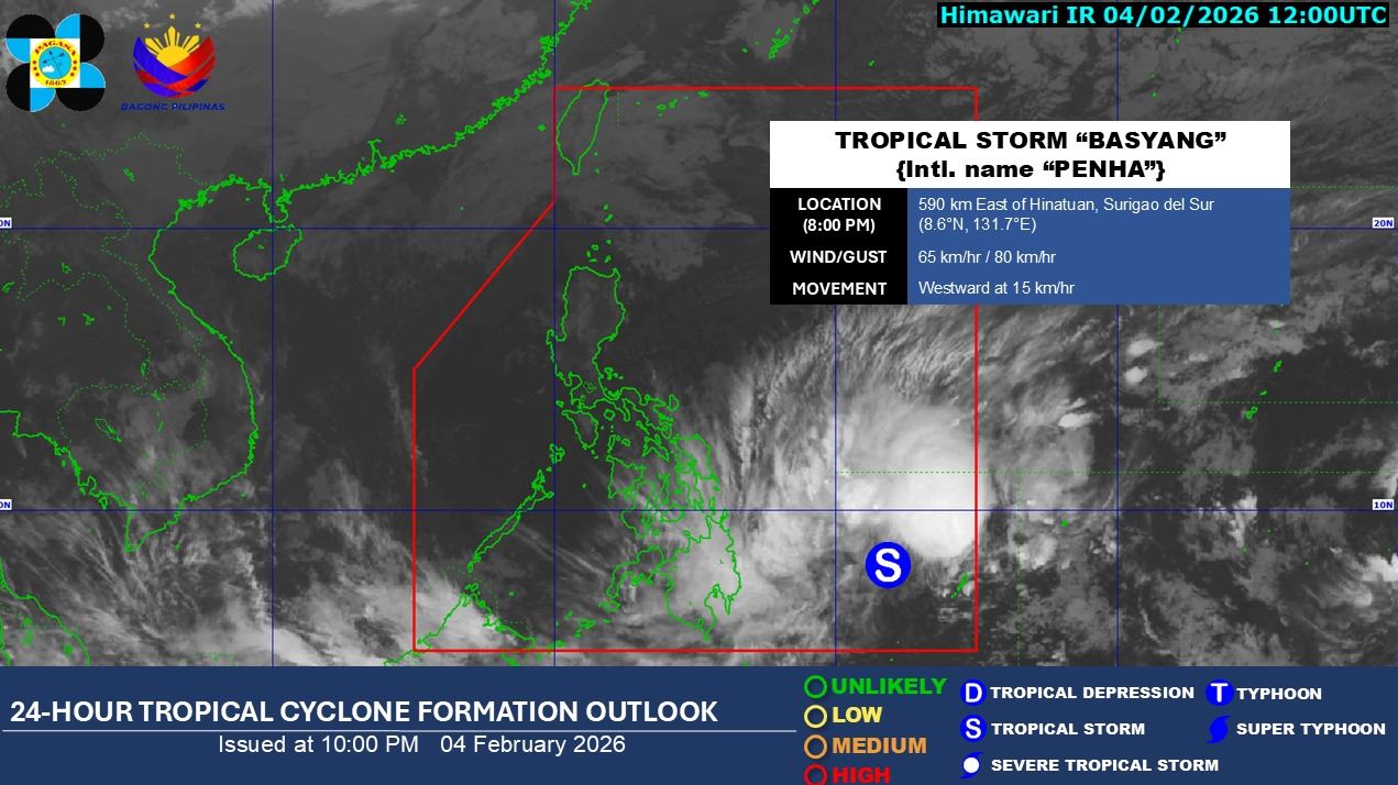
Signal No. 2 is hoisted in Surigao del Sur as tropical cyclone Basyang developed into a tropical storm, PAGASA said Wednesday evening.
The state weather bureau said Basyang developed into a tropical storm at 8 p.m.
At 10 p.m., Basyang was located 560 km east of Hinatuan, Surigao del Sur. It is carrying maximum sustained winds of 65 km/h near the center, gustiness of up to 80 km/h, and is moving westward at 15 km/h.
The following areas are under Signal No. 1:
Visayas
- The central and southern portions of Eastern Samar (Guiuan, Salcedo, Mercedes, Giporlos, Balangiga, Lawaan, Quinapondan, General Macarthur, Hernani, Llorente, Maydolong, Balangkayan, City of Borongan, San Julian, Sulat, Taft)
- The southern portion of Samar (Marabut, Basey, Santa Rita, Villareal, Pinabacdao, Calbiga, Hinabangan, San Sebastian, Talalora, Daram, Zumarraga)
- Biliran
- Leyte
- Southern Leyte
- Bohol
- Cebu
- Siquijor
- Negros Oriental
- Negros Occidental
- Guimaras
- Iloilo
Mindanao
- Dinagat Islands
- Surigao del Norte
- Agusan del Norte
- Agusan del Sur
- The northern portion of Davao Oriental (Boston, Cateel, Baganga)
- The northern portion of Davao de Oro (Compostela, Monkayo, Montevista, Laak)
- The northern portion of Davao del Norte (Kapalong, San Isidro, Asuncion)
- Misamis Oriental
- Camiguin
- The northern and eastern portions of Bukidnon (San Fernando, City of Malaybalay, Cabanglasan, Impasug-Ong, Malitbog, Sumilao, Manolo Fortich, Libona, Baungon, Lantapan)
“It must be emphasized that heavy rainfall and severe winds may still be experienced in localities outside the landfall point and the forecast confidence cone,” state meteorologists said.
PAGASA explained that minimal to minor impacts from strong winds may occur in areas under Wind Signal No. 1, while minor to moderate impacts from gale-force winds may persist in areas under Wind Signal No. 2.
Meanwhile, a surge of the Northeast Monsoon will bring strong to gale-force gusts over Metro Manila, Apayao, Abra, Batanes, Babuyan Islands, the northern portion of mainland Cagayan, Central Luzon, most of Southern Luzon, Visayas, and most of Mindanao on Thursday.
A minimal to moderate risk of storm surge with peak heights reaching up to 2.0 m is expected within the next 48 hours over the low-lying or exposed coastal communities of Dinagat Islands, Surigao del Norte, Surigao del Sur, Agusan del Norte, Davao Oriental, Misamis Oriental, Camiguin, Southern Leyte, and Bohol.
A gale warning is also in effect over the eastern seaboards of Visayas and Mindanao.
Basyang is expected to move generally westward for the next 24 hours before turning west northwestward beginning Thursday evening.
“On the forecast track, the center of Basyang will make its initial landfall over eastern Mindanao between tomorrow evening and Friday (06 February) early morning,” PAGASA said.
“Basyang will then traverse the landmass of northeastern Mindanao and Central and Western Visayas and emerge over Sulu Sea by Saturday morning. By Saturday afternoon or evening, Basyang will cross the northern portion of Palawan, then re-emerge over the West Philippine Sea,” it added.
The state weather bureau further said Basyang is expected to gradually intensify while over the Philippine Sea.
However, after its initial landfall, it will weaken into a tropical depression while traversing Visayas and will be downgraded to low pressure area by Sunday.
Several areas on the path of Basyang have earlier suspended classes and government work.
The local government of Hinatuan, Surigao del Sur has begun enforcing preemptive evacuations in preparation for the effects of Basyang.
Meanwhile, the Loboc Bohol Tourism announced that all water-related activities along the Loboc River in Bohol will be suspended on Friday, February 6, due to the storm.—LDF, GMA Integrated News
