

Typhoon Sinlaku monitored outside PAR while HPA influences Northern Luzon
An active tropical cyclone is currently being monitored outside the Philippine Area of Responsibility (PAR) as the ridge of a High Pressure Area (HPA) affects parts of Northern Luzon.
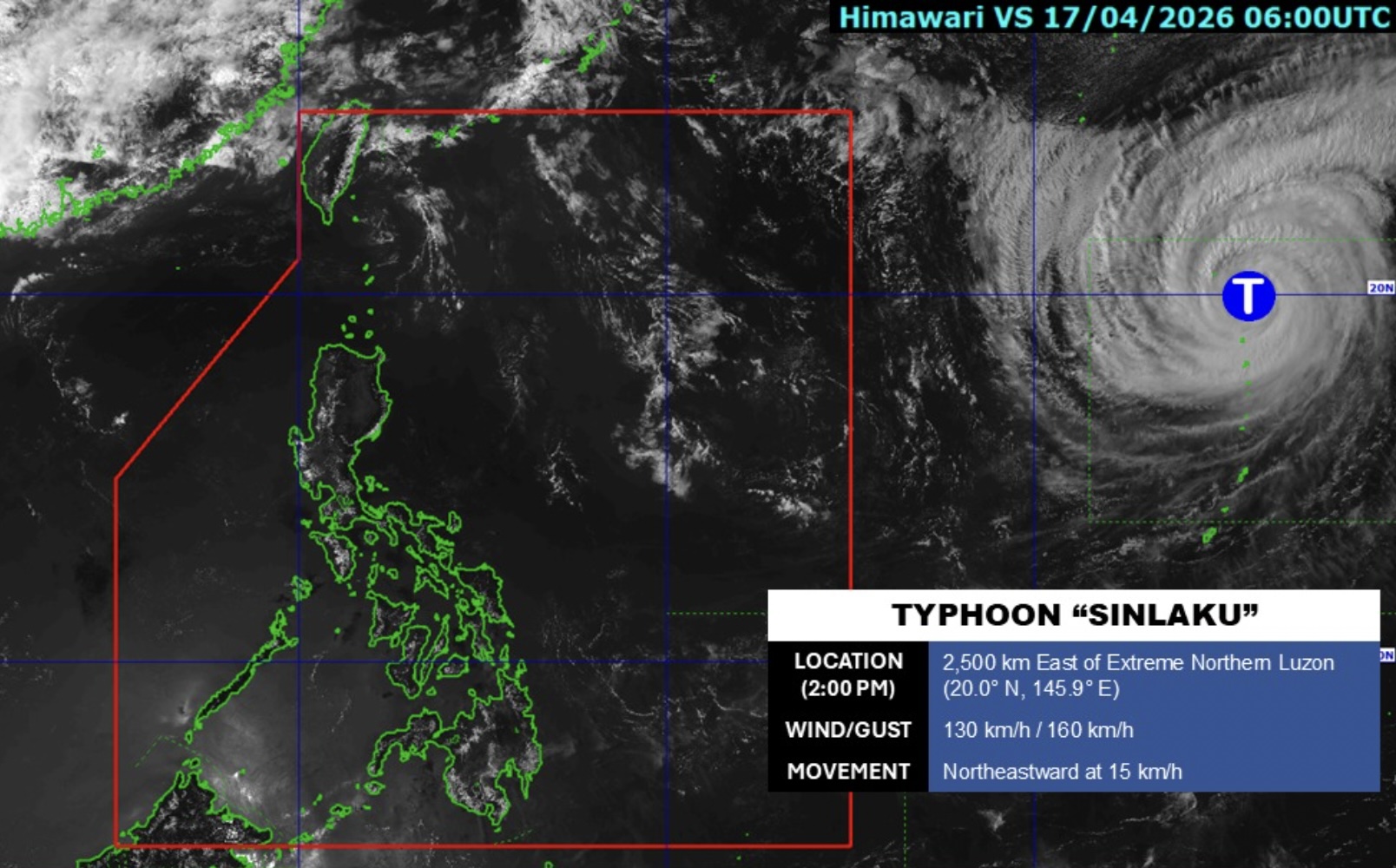
According to PAGASA’s daily weather forecast on Friday afternoon, Typhoon Sinlaku was last seen at 2,500 kilometers east of Northern Luzon and outside the PAR at 3 p.m.
It had maximum sustained winds of 130 kph and gustiness of up to 160kph.
Partly cloudy to cloudy skies with isolated rainshowers or thunderstorms will be felt over the country due to localized thunderstorms.
Possible flash floods or landslides may occur as a result of said weather conditions.
Meanwhile, moderate winds to moderate waters may be felt over the eastern sections of Southern Luzon, Visayas, and Mindanao, and the eastern sections of Northern and Central Luzon.
The rest of the country will have light to moderate winds with slight to moderate seas.
Sunrise in Metro Manila will be at 5:41 a.m. on Saturday. –Jiselle Anne C. Casucian/NB, GMA News
