

Hagupit maintains strength as storm moves closer to PAR - PAGASA
Tropical Storm Hagupit maintained its strength as it continued to move closer to the Philippine Area of Responsibility (PAR), state weather bureau PAGASA said on Thursday evening.
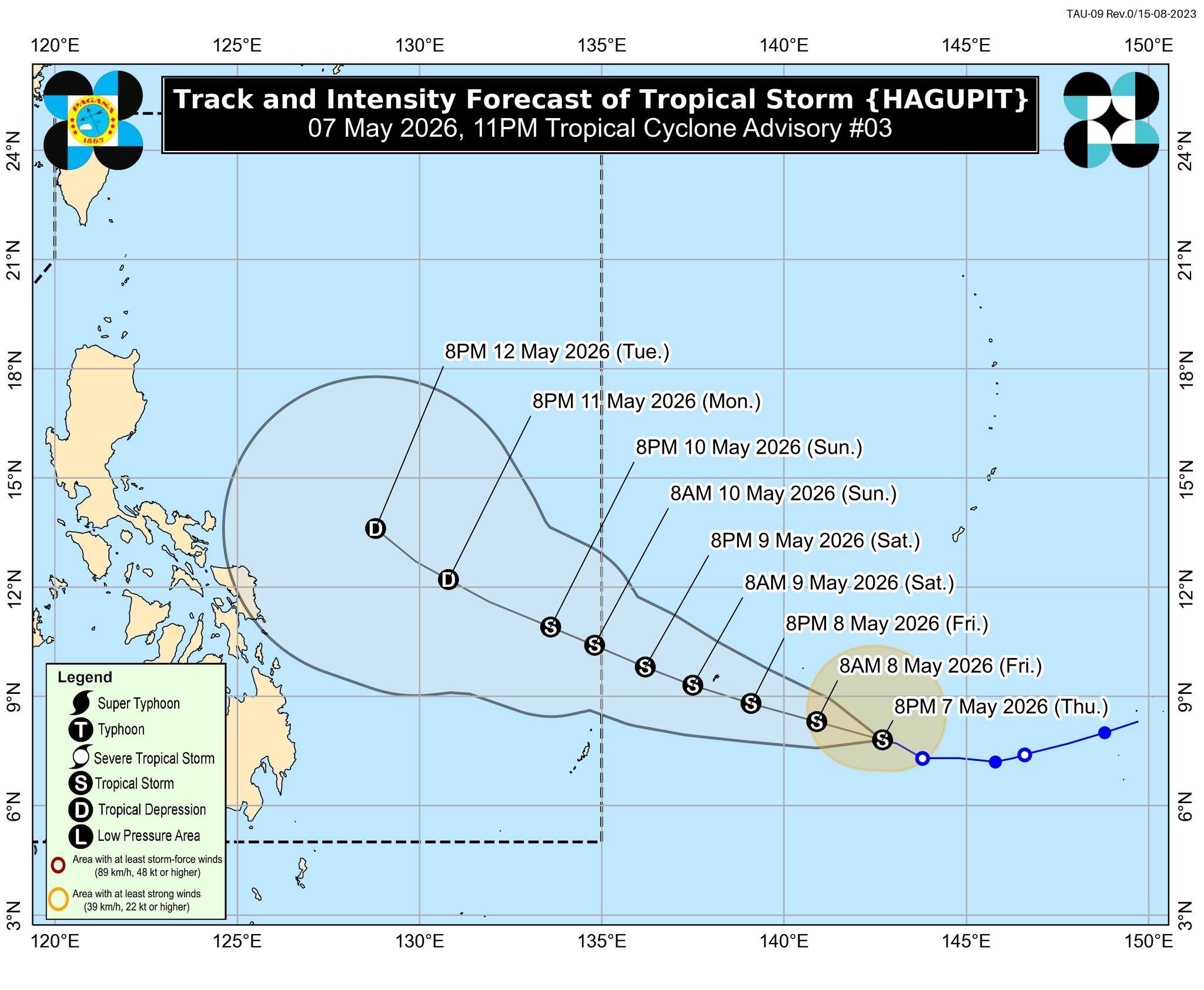
In its Tropical Cyclone Advisory No. 3 issued at 11:00 p.m, state meteorologists said Hagupit is moving west northwest with its center "estimated based on all available data at 1,750 km East of Northeastern Mindanao (OUTSIDE PAR) (7.9°N, 142.2°E).”
For intensity, Hagupit has maximum sustained winds of 65 km/h near the center, gustiness of up to 80 km/h, and central pressure of 1002 hPa.
Hagupit is moving west northwestward at 10 km/h with strong to gale-force winds extend outwards up to 280 km from the center.
PAGASA predicts Hagupit will enter the Philippine Area of Responsibility (PAR) between Saturday evening and Sunday morning and will be given the local name CALOY.
“In the next 24 hours, HAGUPIT will further intensify and may reach its peak intensity as a tropical storm. Afterwards, due to unfavorable environmental conditions, it will begin to weaken and may be downgraded to tropical depression by Monday evening (11 May) while over the Philippine Sea,” the advisory said.
PAGASA added, “HAGUPIT is less likely to directly affect the weather and sea conditions in the next 3 days. Considering these developments, the public and disaster risk reduction and management offices concerned are advised to continue monitoring for updates related to this tropical cyclone.”
The next bulletin is scheduled at 11:00 a.m. on Friday.—RF, GMA News
