

TS Caloy maintains strength east of Mindanao; easterlies to bring isolated rains
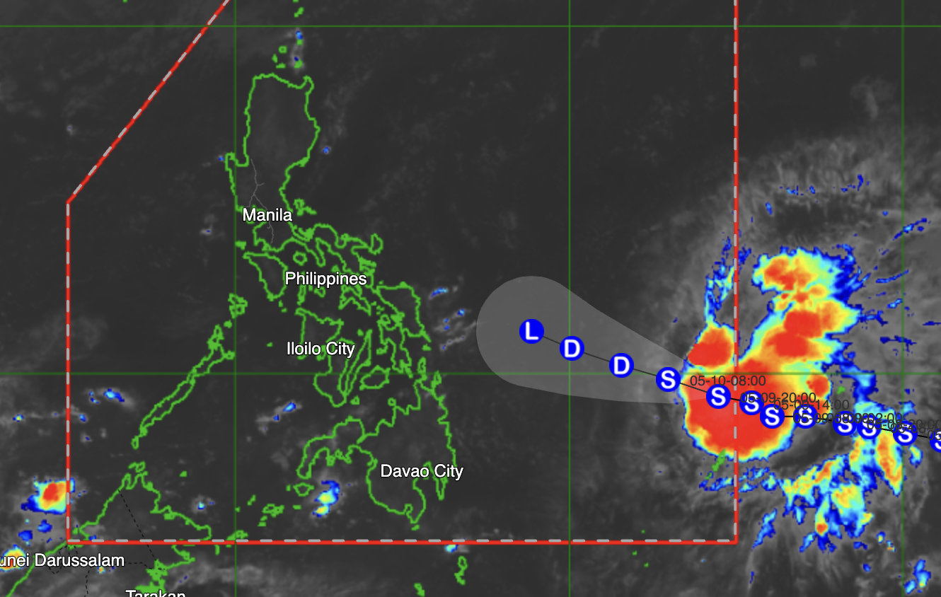
Tropical Storm Caloy maintained its strength Sunday morning as it moved west-northwestward east of northeastern Mindanao, according to the Philippine Atmospheric, Geophysical and Astronomical Services Administration (PAGASA).
In its 4 a.m. weather bulletin, PAGASA said the center of Caloy was estimated at 925 kilometers east of northeastern Mindanao as of 3 a.m.
The tropical storm was packing maximum sustained winds of 65 kph near the center and gusts of up to 80 kph, while moving west-northwestward at 15 kph.
Meanwhile, easterlies continue to affect most parts of the country.
PAGASA said Metro Manila and the rest of the Philippines may expect partly to mostly cloudy skies with isolated rain showers or thunderstorms due to the easterlies.
The weather bureau warned of possible flash floods or landslides during severe thunderstorms.
Moderate to strong winds and moderate to rough coastal waters with wave heights ranging from 1.2 to 2.8 meters are expected over extreme northern Luzon.
At PAGASA’s Science Garden station in Diliman, Quezon City, the maximum temperature recorded on Saturday reached 35.6 degrees Celsius at 2 p.m., while the minimum temperature was logged at 26.4 degrees Celsius at 6 a.m.Sunrise on Sunday is at 5:30 a.m., while sunset is expected at 6:15 p.m.—MCG, GMA News
