

Caloy continues to weaken over PH Sea — PAGASA
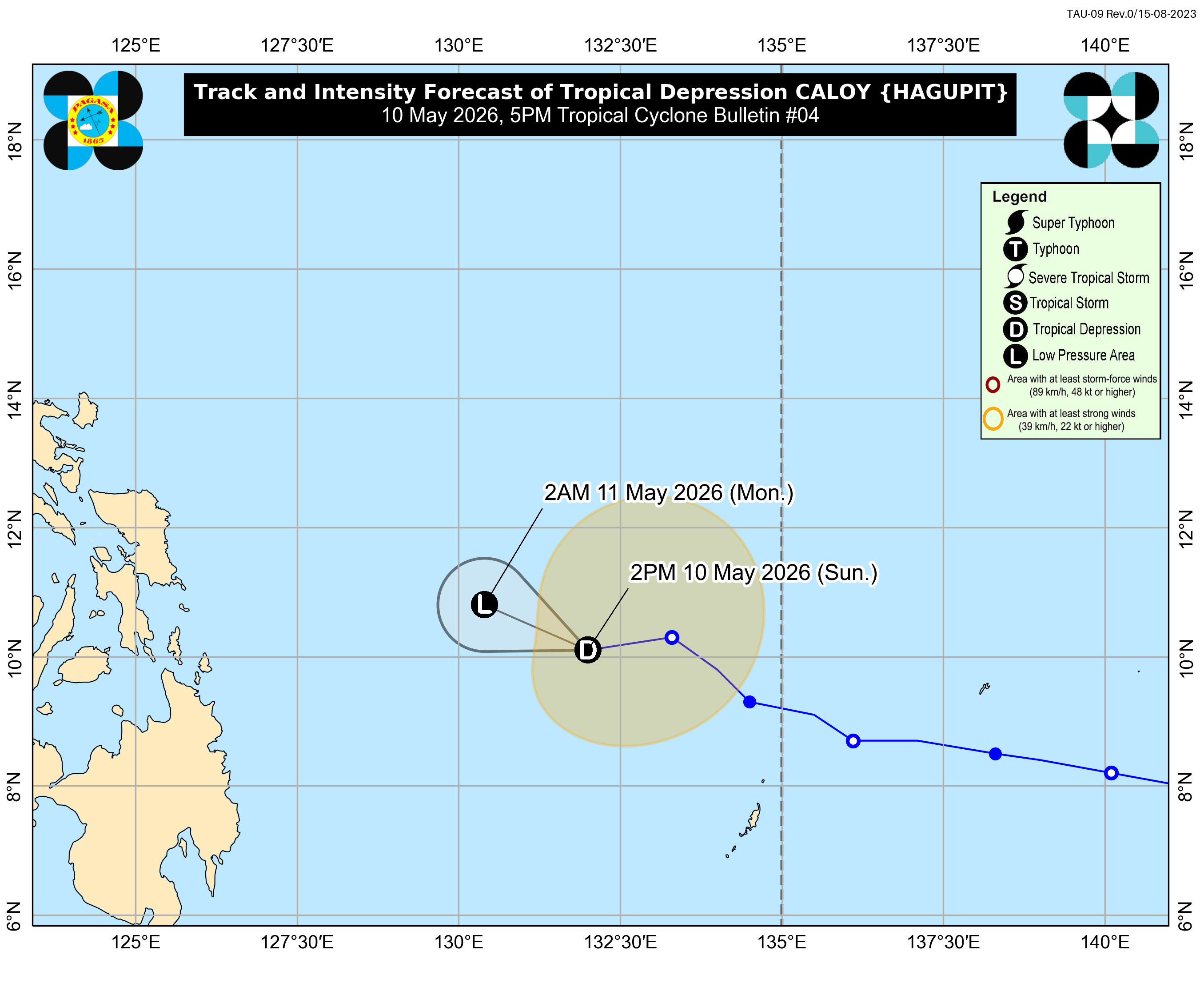
Tropical Depression Caloy continues to weaken over the Philippine Sea east of the Caraga region and is unlikely to directly affect the country, the state weather bureau PAGASA said.
In its 5 p.m. weather bulletin, PAGASA said Caloy will continue moving west-northwestward over the next 12 hours while remaining over the Philippine Sea, far from the Philippine landmass.
The center of the tropical depression was last located 680 kilometers east of Surigao City, Surigao del Norte.
Caloy packs maximum sustained winds of 45 kilometers per hour near the center and gustiness of up to 55 kph.
PAGASA said Caloy is forecast to further weaken into a remnant low on Monday, May 11.
Meanwhile, the 24-hour weather forecast issued at 4 p.m. said the easterlies will affect the country on Monday.
The easterlies are expected to bring partly cloudy to cloudy skies with isolated rain showers or thunderstorms over Metro Manila and the rest of the country.
PAGASA warned of possible flash floods or landslides during severe thunderstorms.
The maximum temperature recorded at the PAGASA Weather Station in Science Garden, Quezon City, reached 34.8°C at 2 p.m., while the minimum dropped to 25.0°C at 5 a.m.
Sunset is expected at 6:15 p.m. today, while sunrise on Monday is expected at 5:30 a.m.—MCG, GMA News
