

Caloy still moving west northwestward over Philippine Sea
Tropical Depression Caloy continues to move west northwestward while over the Philippine Sea and is still expected to weaken into a low pressure area (LPA) by today, May 11.
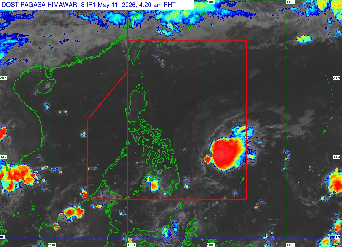
In its 5 a.m. tropical cyclone bulletin, PAGASA said Caloy was estimated to be 530 kilometers east of Guiuan, Eastern Samar as of 4 a.m. Monday.
It has maximum sustained winds of 45 km/h near the center, gustiness of up to 55 km/h, and central pressure of 1004 hPa.
The state weather bureau said the tropical depression is moving west northwestward at 15 km/h and unlikely to directly affect the country since there are no wind signals in effect.
“Caloy will continue moving west northwestward in the next 12 hours and will remain over the Philippine Sea, far from the Philippine landmass. This weather disturbance is forecast to further weaken into a remnant low today, 11 May,” PAGASA added.
The seaboards of Batanes, Cagayan, Isabela, Ilocos Norte, northern Ilocos Sur, Aurora, Camarines Norte, Northern Samar, Eastern Samar, and Surigao del Sur; the western seaboard of Pangasinan; the northern seaboards of Camarines Sur; the northern and eastern seaboards of Quezon including Polillo Islands and Catanduanes; and the eastern seaboards of Albay, Sorsogon, Eastern Samar, Dinagat Islands, Siargao-Bucas Grande Islands, and Davao Oriental may experience moderate seas over the next 24 hours.
The state weather bureau advised mariners of motorbancas and similarly sized vessels to take precautionary measures while venturing out to sea and, if possible, avoid navigation under these conditions. — JMA, GMA News
