

Caloy maintains strength, moves northward
Tropical Depression Caloy maintained its strength as it moves northward while over the sea east of Eastern Visayas, the state weather bureau PAGASA said.
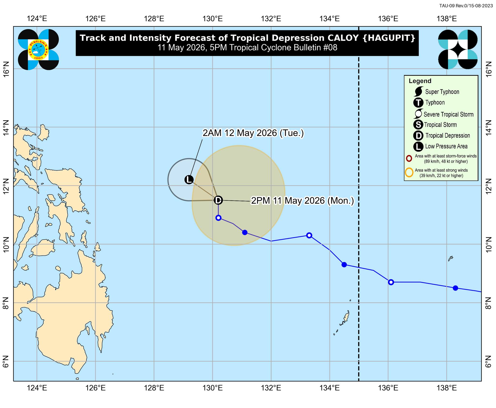
According to the 5 p.m. weather bulletin, the center of Caloy was last monitored at 470 kilometers east of Guiuian, Eastern Samar. It packs with maximum sustained winds of 45 kilometers per hour near the center and gustiness of up to 55 kilometers per hour.
But PAGASA said that Caloy is unlikely to directly affect the country throughout the forecast period.
The state weather bureau said the tropical depression will continue moving generally northwestward in the next 12 hours and will remain over the Philippine Sea, far from the Philippine landmass.
Caloy is predicted to further weaken into a remnant low tonight or tomorrow early morning, May 12, said PAGASA.
Meanwhile, the 24-hour-weather forecast issued at 4 p.m. said that the trough of Caloy could bring cloudy skies with scattered rains and thunderstorms over Eastern Samar, Dinagat Islands, and Surigao del Norte.
On the other hand, the easterlies is forecast to bring partly cloudy to cloudy skies with isolated rainshowers or thunderstorms over Metro Manila, the rest of Luzon, and the rest of Visayas.
Local thunderstorms may bring partly cloudy to cloudy skies with isolated rainshowers or thunderstorms over the rest of Mindanao. —Vince Angelo Ferreras/RF, GMA News
