

 GMA Brandtalk
 Tracking
 Archives

Tropical Depression Domeng may enter PAR Thursday - PAGASA
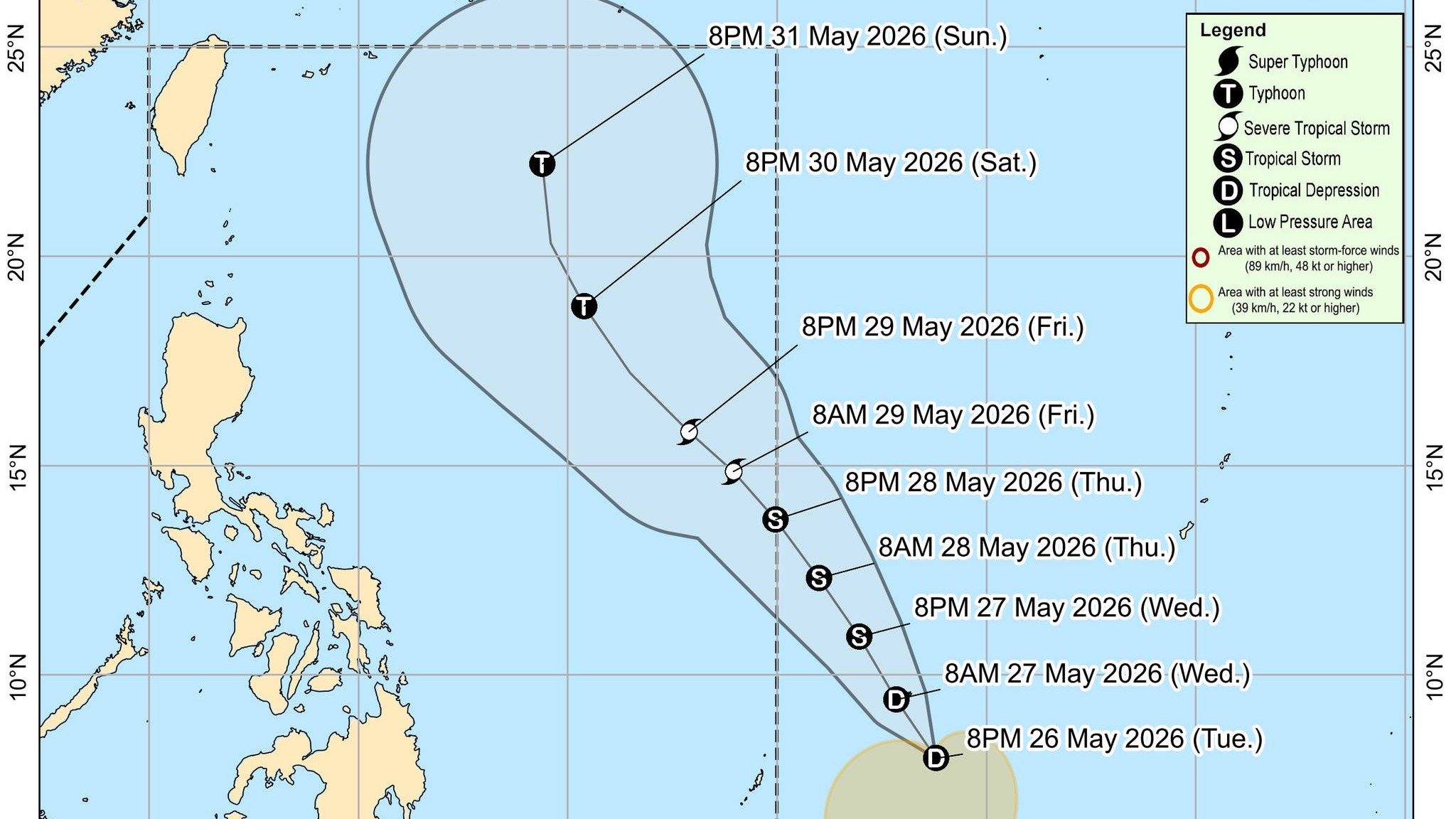
A tropical depression is expected to enter the Philippine Area of Responsibility (PAR) on Thursday afternoon or evening as Tropical Storm Domeng, the state weather bureau said Tuesday.
In its 11 p.m. weather bulletin, PAGASA said the tropical storm may eventually reach typhoon category on Saturday, May 30, over the Philippine Sea, with a low chance of making landfall over the country.
As of 10 p.m., the center of the tropical depression was estimated at 1,330 km east of Northeastern Mindanao, outside PAR, and is moving southward slowly.
Although it is less likely to make landfall, PAGASA said its winds may affect extreme northern Luzon, and can expect moderate to rough sea conditions over the seaboards this weekend—raising of gale warnings over the area is also possible.
According to PAGASA, the highest tropical cyclone wind signal that may be raised during the passage of this tropical cyclone is Wind Signal No. 1, and it may also enhance the Southwest Monsoon on Saturday.
Considering these developments, PAGASA has advised the public and the disaster risk reduction and management offices to continue monitoring for updates related to this tropical cyclone. —Lyjah Tiffany Bonzo/RF, GMA News

