

 GMA Brandtalk
 Tracking
 Archives

PAGASA: Trough of tropical depression to bring rains in Mindanao
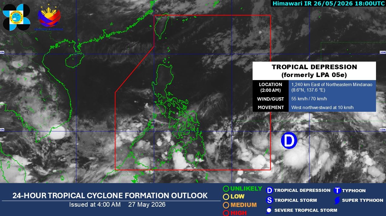
The trough of tropical depression outside the Philippine Area of Responsibility is expected to bring rains to some parts of Mindanao, according to PAGASA.
In its 4 a.m. bulletin, the state weather bureau said it continues to monitor the cyclone, spotted 1,230 kilometers east of Northeastern Mindanao, and with maximum sustained winds of 55 km/hour near the center and gustiness of up to 70 km/h.
The cyclone is moving west northwestward at 10 km/h.
Zamboanga Peninsula, BARMM, SOCCSKSARGEN, Lanao del Norte, Misamis Occidental, and Palawan will experience cloudy skies with scattered rains and thunderstorms due to the southwesterly windflow.
The rest of Mindanao will have cloudy skies with scattered rains and thunderstorms as a result of the Trough of TDPossible flash floods or landslides due to moderate to at times heavy rains
Metro Manila and the rest of the country will have partly cloudy to cloudy skies with isolated rainshowers or thunderstorms brought about by localized thunderstorms.
Sunrise is at 5:26 a.m. and sunset is at 6:20 p.m. —LDF, GMA News

